Where Autumn Takes the Back Roads
Autumn has begun its journey through Appalachia, but it is in no hurry.
Last week, we began beneath the shadow of Katahdin, where the first hints of color were appearing across the northern Maine wilderness. Now we turn southwest, following the mountains toward Rangeley, Carrabassett Valley and the long ridges of Bigelow, into a part of Maine where September still belongs partly to summer.
The forests are mostly green. The lakes still reflect mountains wearing their summer colors, and warm afternoons can make autumn seem farther away than it really is. Then comes a cool morning, a maple touched with red along the roadside, or a streak of yellow appearing on a distant slope.
The season is here. It simply hasn’t announced itself loudly yet.
That is part of the pleasure of chasing fall rather than waiting for peak foliage. Autumn is not something that happens to the mountains overnight. It gathers slowly, almost tree by tree, until one day the landscape we thought we knew has become something entirely different.
In Western Maine, we have arrived in time to watch it begin.
The Road Into Rangeley
There are places best discovered after you leave the fastest road behind.
The Rangeley Lakes region is one of them.
Here, lakes stretch beneath wooded mountains, roads rise and fall with the land, and the Appalachian landscape seems to open a little farther with every bend. Rangeley sits among six large lakes and hundreds of smaller ponds and waterways, with mountains rising beyond them and the Appalachian Trail crossing the surrounding high country.
The Rangeley Lakes National Scenic Byway offers one of the loveliest ways into this landscape. It winds through mountain and lake country where the temptation to keep driving competes constantly with the temptation to pull over.
Eventually, there is one place where you should.
On Route 17, Height of Land overlooks Mooselookmeguntic Lake and Upper Richardson Lake, their long blue waters reaching between mountains and forested ridges.
It is an enormous view.
In October, people come here for hillsides washed in red, orange and gold. But early September offers something quieter. Green still claims most of the mountains, while the first changing trees appear almost like brushstrokes across the landscape.
Stand here long enough and it becomes easier to understand what we are chasing.
Not simply color, but change.
Stay Awhile in Rangeley
Rangeley is the kind of mountain town that gives you reasons to put away the itinerary for a while.
The lakes have drawn people here for generations, particularly anglers, but there are plenty of ways to experience the region without ever casting a line. Hiking trails disappear into the surrounding woods. Canoes and kayaks slip onto quiet water. Roads wander toward overlooks, ponds and mountains that seem to invite one more detour.
At nearly 900 acres, Rangeley Lake State Park stretches along the southern shore of Rangeley Lake and offers camping, boating, swimming and access to the water. It can also be something much simpler: a place to sit beside a Maine lake and watch the mountains on the opposite shore.
Rangeley’s history as a destination is still visible around those lakes. Generations before foliage reports helped travelers time an autumn drive, sporting camps were bringing visitors into Western Maine to fish, hunt and spend time in the woods.
Near Oquossoc, Bald Mountain Camps grew from that tradition. Its history reaches into the 1800s, and today the second-generation family-run property has just 14 log cabins. Private porches, fireplaces or wood stoves keep some of the character of the old Maine sporting-camp experience intact.
Along the northeastern shore of Rangeley Lake, North Camps takes a similarly small-scale approach. Thirteen rustic cabins sit across 20 wooded acres, with screened porches, wood stoves, a private beach and canoes and kayaks available for guests. The camps remain open into the fall hunting season, when September’s cool nights begin giving way to the colder days ahead.
And on Rangeley Lake, Loon Lodge Inn & Restaurant occupies a restored lodge that has been welcoming guests since 1899. Today it combines guest rooms with a restaurant and pub overlooking the lake. During the warmer season, boaters can even arrive from the water to dock and dine.
None of these places is necessary to experience Rangeley, and they are far from the region’s only choices. But together they preserve something interesting about the way people have long traveled here.
The mountains are not scenery you return to after leaving your hotel in the morning. In places like these, the lake and woods remain just outside the door.
The Rangeley Lakes Region Chamber of Commerce maintains current information on these and other lodging options throughout the area.
A Town Between the Lakes and Mountains
It would be easy to come to Rangeley, photograph the scenery and keep driving.
It would also mean missing part of the place.
Downtown, older buildings continue to serve new generations. Furbish Brew House & Eats occupies a restored 1912 building where original wood trim and hutches remain. A brick oven built inside by a Maine artist now turns out wood-fired pizzas, and the building is also home to Rangeley’s first brewery.
That mixture of old and new feels appropriate here. Western Maine carries its history without needing to freeze itself inside it.
For something simpler in the morning, Classic Provisions operates as a small café, breakfast and sandwich stop, and gourmet market on Main Street. On Thursdays, its back parking lot becomes the Downtown Farmers Market from 10 a.m. to 2 p.m., bringing together organic produce and meats, locally made products and work from area artists.
On Tuesdays, the South Shore Drive Farmers Market offers another opportunity to encounter the region beyond its overlooks.
A farmers market may seem like a small thing beside a mountain range, but that is partly why it matters.
These mountains are not an empty wilderness arranged for visitors. People live here, make things here, grow food here and gather here.
The mountains may bring you to Rangeley, but the community tells you where you are.
Walk With Someone Who Knows the Country
September also offers opportunities to get out of the car and experience the landscape more closely.
The Rangeley region’s T.R.A.C. program organizes guided hikes and paddles on Tuesdays and Fridays with local volunteer leaders familiar with the routes they lead. On September 8, the date of this stop on our Chasing Fall journey, both T.R.A.C. and the South Shore Drive Farmers Market were on the local calendar.
There is something fitting about that.
You can certainly explore Western Maine independently. But walking a trail or paddling a stretch of water with someone familiar with the country can reveal things easily missed when the goal is simply reaching the next viewpoint.
For travelers following this journey later in the season, the Rangeley Region events calendar is worth checking before a visit. Markets, guided outings and seasonal events change throughout the year.
Stories Behind the Scenery
Near Rangeley in Oquossoc, the Outdoor Heritage Museum offers another way to understand why these lakes and mountains have drawn people for so long.
Its collections explore the region’s outdoor history, including guides, sporting traditions and the people whose lives became connected to the woods and waters of Western Maine. That history helps place the old camps around Rangeley in a larger story.
On September 19, the museum holds its Fall Festival, with Maine arts, crafts and antiques vendors gathering on the museum grounds as cooler weather begins settling over the region.
For travelers whose dates happen to align, a small local festival can become an unexpected part of an autumn trip. For everyone else, the museum offers something equally valuable: context.
Scenery becomes richer when you begin learning the stories held inside it.
Deeper Into the Western Mountains
Eventually, the road calls again.
South and east of Rangeley, Route 27 follows the mountains through Kingfield and Carrabassett Valley, where the Carrabassett River threads through a valley surrounded by some of Maine’s highest country. Mount Abraham rises nearby. Sugarloaf dominates part of the skyline. Beyond it waits the unmistakable profile of the Bigelow Range.
The Maine Appalachians feel bigger here.
Carrabassett Valley is well known as the home of Sugarloaf, but winter is only one chapter in the life of these mountains. Hiking and mountain biking trails spread through the valley and surrounding forests. The Appalachian Trail crosses the high country nearby, while Maine Huts & Trails reaches through the backcountry toward Flagstaff Lake.
If hunger catches up somewhere along the way, The Bag & Kettle has been part of Carrabassett Valley for decades. It is one of those longstanding local stops that can simply become part of a day spent moving through the mountains rather than a destination around which the day needs to be built.
Because the landscape is still the reason we came.
In September, there is a particular pleasure in driving these mountain roads before autumn reaches its crescendo. A hillside can appear almost entirely green from a distance, only to reveal scattered red maples as the road draws closer. Higher slopes begin changing on a different schedule from sheltered valleys, and morning fog may hide a ridge that appears again beneath blue sky an hour later.
The mountains reveal themselves gradually.
So does the season.
Beneath the Bigelow Range
Then Bigelow Preserve appears.
The preserve surrounding it protects more than 36,000 acres of mountain wilderness, including the entire Bigelow Range and seven summits. West Peak rises to 4,150 feet, placing it among Maine’s ten summits above 4,000 feet. To the north, the mountains descend toward the broad waters of Flagstaff Lake.
The Appalachian Trail crosses the range on its long journey toward Katahdin.
For experienced hikers prepared for mountain terrain, Bigelow offers the opportunity to climb into a landscape where ridges seem to roll away toward the horizon. The high country is beautiful, but it should be approached with respect. Weather changes, distances are real, and a mountain that looks inviting from the valley remains a mountain once you begin climbing it.
Fortunately, Bigelow does not reserve its beauty for those who reach the summit.
Travelers can experience the range from Route 27 through Carrabassett Valley, from Cathedral Pines in Eustis and from the overlook on Eustis Ridge. Each offers a different relationship with the mountains.
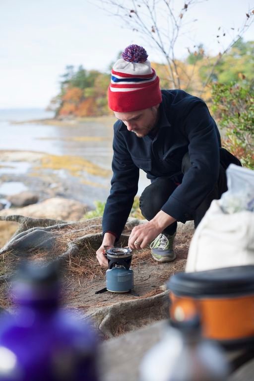
There is no single correct way to experience Appalachia. Some of us meet a mountain by climbing it. Others follow the road beneath it, stop at an overlook, walk a gentler trail or simply stand somewhere beautiful and look up.
The mountain does not ask how you arrived.
Where the Mountains Meet the Water
On the northern side of Bigelow, the landscape changes again.
Flagstaff Lake spreads beneath the mountains, giving travelers the chance to look back toward the Bigelow Range from the water. From a canoe or kayak, the scale of the mountains becomes apparent in a different way. Forest rises from the shoreline toward the ridges, and the long mountain profile follows the lake.
As September deepens into October, that forest will become part of the spectacle.
Imagine paddling across cool water while autumn climbs the mountains ahead of you, the shoreline beginning to glow with yellow and red and the higher ridges rising beyond it.
For now, the transformation is subtler.
Flagstaff is also part of the Northern Forest Canoe Trail, a 740-mile paddling route connecting waterways across New York, Vermont, Quebec, New Hampshire and Maine. Visitors do not need to undertake anything remotely that ambitious to appreciate this stretch of it. Even a much smaller encounter with the lake can change the way you see Bigelow.
For travelers wanting to move deeper into the landscape, Maine Huts & Trails maintains a trail and hut system connecting parts of Carrabassett Valley and the Flagstaff Lake region. Reaching the huts requires human-powered travel rather than simply driving to the door, making them an option for those wanting to leave the road behind for a while.
Some places ask you to slow down before they reveal very much.
Western Maine is one of them.
Before the Mountains Turn
If you come to Western Maine in early September expecting mountains blazing with peak foliage, you have arrived too soon.
But perhaps not at the wrong time.
Western Maine generally reaches peak fall color around the second week of October. In early September, much of the landscape is still green, and the transition is only beginning.
There is beauty in catching autumn before everyone agrees that autumn has arrived.
You notice smaller things: one red branch extending over a road, yellow gathering at the edge of a pond, a cold morning that makes you reach for another layer, the smell of damp leaves beneath trees that still look like summer, a little more darkness arriving each evening.
None of it is dramatic on its own. Together, it is unmistakable.
The mountains are turning toward autumn.
Come Back for the Color
There is another wonderful thing about seeing Western Maine now.
You know what is coming.
In another few weeks, the view from Height of Land will be transformed. Color will gather around Rangeley’s lakes. Carrabassett Valley will deepen into autumn, and the slopes beneath Bigelow will carry the season from the waterline toward the high ridges.
The roads we have followed through mostly green mountains will become some of Maine’s great fall drives.
Perhaps that is reason enough to come twice.
Come in September to watch autumn begin.
Come back in October to see what it became.
Plan Your Western Maine Journey
Western Maine is better suited to wandering than rushing, so give yourself enough time to explore beyond a single scenic drive if you can.
The Rangeley Lakes Region Chamber of Commerce is a useful starting point for current lodging, restaurants, local attractions, events and recreation. The Maine Office of Tourism’s Rangeley Lakes guide provides broader information for planning time in the region.
For Bigelow Preserve, Flagstaff Lake and Maine’s public reserved lands, consult the Maine Bureau of Parks and Lands. Travelers interested in the hut and trail network around Carrabassett Valley and Flagstaff Lake can find current information through Maine Huts & Trails.
The Rangeley Region events calendar is worth checking shortly before a trip for farmers markets, guided outings, museum programs and other seasonal happenings.
Most importantly for our particular journey, keep the Maine Fall Foliage Report close. Conditions are updated throughout foliage season, which is far more useful than assuming autumn will follow exactly the same calendar every year.
Mountain weather deserves respect in any season. Check current conditions before hiking or paddling, carry what your route requires and remember that temperatures and weather at higher elevations can differ considerably from those in the valleys.
Then leave some empty space in the itinerary.
Take the road you had not planned to take. Stop at the overlook. Walk down to the water. Browse a market if you happen upon one. Sit somewhere local when you get hungry.
Western Maine will probably find something to put in the spaces you left open.
Chasing Fall South
We could stay in Western Maine.
That may be the hardest part of chasing autumn through Appalachia. Every place we visit is still changing when it is time for us to leave.
Behind us, Rangeley’s lakes will soon be surrounded by color. Carrabassett Valley will move deeper into the season. Bigelow will stand above forests transformed by October, and somewhere along the Appalachian Trail, hikers will walk beneath a canopy that looks nothing like the one above them today.
But autumn is moving south.
So are we.
Next week, we cross into New Hampshire and enter the White Mountains, where roads climb through mountain passes, the Appalachian Trail crosses some of its most storied terrain and Mount Washington rises above a landscape already beginning to feel the approach of fall.
For now, Western Maine remains behind us, still mostly green, still quietly changing.
We arrived before the show.
And somehow, that made it worth seeing.