Where Autumn Comes Down From the Mountains
Last week, we climbed into New Hampshire’s White Mountains looking for autumn. In the valleys, summer was still holding on. Higher in the notches and along the mountain roads, yellow had begun appearing among the green, with scattered reds and oranges offering hints of what was coming. Elevation allowed us, briefly, to catch up with the season.
This week, we turn west toward Vermont, leaving the White Mountains behind in New Hampshire as the Green Mountains rise on the other side of the Connecticut River Valley. We are still traveling through the Appalachians, but the landscape begins telling a different story. The mountains remain close, yet farms, villages and working forests become increasingly difficult to separate from them. Roads follow the valleys, pastures end where wooded slopes begin, and small towns gather along rivers and crossroads beneath mountains that determine much of the shape of life around them.
By September 22, autumn is underway in Vermont. The state’s weekly foliage reports are already finding color in roadside trees and wetter areas, while the Upper Green Mountains have begun to turn. Reds, oranges and yellows are appearing, but plenty of green remains. That makes this an interesting time to arrive because we’re early enough to watch Vermont changing rather than simply admire it after the transformation is complete. Instead of climbing higher to find autumn, we’re going to watch it make its way down toward the places where people live.
Following the Green Mountains
Vermont Route 100 gives us a road to follow. Running north and south through much of the state, the highway repeatedly brings travelers back to the mountains. Around Stowe and the Upper Green Mountains, it connects communities while mountain roads lead toward Mount Mansfield, Smugglers’ Notch and the forests surrounding them.
Yet the road itself may be more important to our journey than any single destination along it. Drive long enough and Vermont begins revealing itself in layers. Forest gives way to a farm field. A mountain appears beyond a barn. The road narrows as it enters a village and opens again on the other side. Rivers accompany portions of the journey, while side roads disappear toward places where the mountains seem to close around the valley.
It is a journey that rewards detours, and somewhere among all of this are the trees everyone has come to see: maples.
The Trees That Make Two Seasons
In autumn, it is easy to think of Vermont’s maples simply as color. Sugar maples can produce some of the brilliant yellows, oranges and reds associated with a New England fall, and by late September those colors are beginning to interrupt the green forests covering the mountains. Visitors stop along roadsides to photograph them, and entire hillsides become destinations because of them.
But in Vermont, some of those trees belong to another season entirely. When winter begins loosening its hold and nights still fall below freezing while daytime temperatures rise above it, sap begins flowing. Sugar makers tap appropriately sized maple trees and collect the clear sap that will eventually become syrup. A typical sugaring season lasts only four to six weeks, and on average it takes roughly 40 gallons of sap to produce a single gallon of maple syrup, although the amount varies.
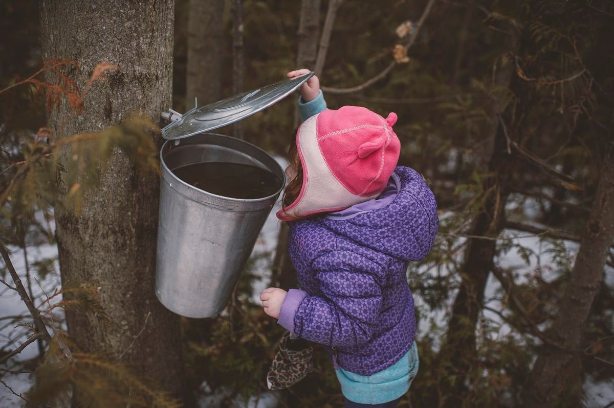
The tradition reaches much farther back than the familiar Vermont sugarhouse. Indigenous peoples of North America were making maple sugar long before European settlers arrived, and the basic relationship among tree, season, sap and heat has endured even as the technology surrounding it has changed.
Modern sugaring can look very different from the old image of a metal bucket hanging from a tree. Tubing may carry sap through a sugarbush to collection tanks. Vacuum systems can assist collection, reverse osmosis can remove some of the water before boiling, and modern evaporators turn the remaining sap into syrup. Smaller producers may work differently, and methods vary from one sugarhouse to another, but what hasn’t changed is the dependence on the trees and the weather.
That makes a Vermont maple forest something more than autumn scenery. The same trees attracting travelers in September will be watched for entirely different reasons when freezing nights and warmer days return near the end of winter. Travelers interested in seeing that connection firsthand can use the Vermont Maple Sugar Makers’ Association sugarhouse map to find producers throughout the state. Some welcome visitors outside the traditional spring sugaring season, although hours vary and should be checked before making a special trip.
In September, everyone is looking at the leaves. A few months from now, Vermont will be waiting for the sap.
Stowe Beneath the Mountains
Stowe sits beneath Vermont’s highest mountain, Mount Mansfield, in a landscape where the Green Mountains are rarely far from view. Route 100 brings us into a community whose identity has long been intertwined with the surrounding mountains, although September arrives before winter recreation begins defining the season.
This is the quieter interval when summer hasn’t entirely disappeared and autumn hasn’t completely taken over. The first color is spreading through the mountains while cooler mornings and evenings signal what the calendar already knows. The community calendar changes with the landscape, too, as farmers markets continue while September and early October bring arts events, festivals and seasonal gatherings.
The individual festivals aren’t really the point. What interests us is what happens when a natural season becomes a community season. Autumn doesn’t arrive in Vermont only in the trees. It begins appearing on calendars, at markets and in the reasons people gather. The mountains change color behind town while people below them find their own ways of marking the transition.
Before continuing south, this is also a place where taking the slower road pays off. A side trip toward Smugglers’ Notch brings travelers deeper into the mountains, while Mount Mansfield provides the enormous backdrop that helps explain why Stowe can feel less like a town beside the Green Mountains than a town within them. From here, Route 100 carries us south.
Into the Mad River Valley
The Mad River Valley brings together several of the threads we’ve been following. Waitsfield and Warren sit among farms, forested slopes and the Mad River, with the Green Mountains defining the horizon around them. Here, the Vermont that can so easily become a collection of postcard images begins making more sense as a lived landscape.
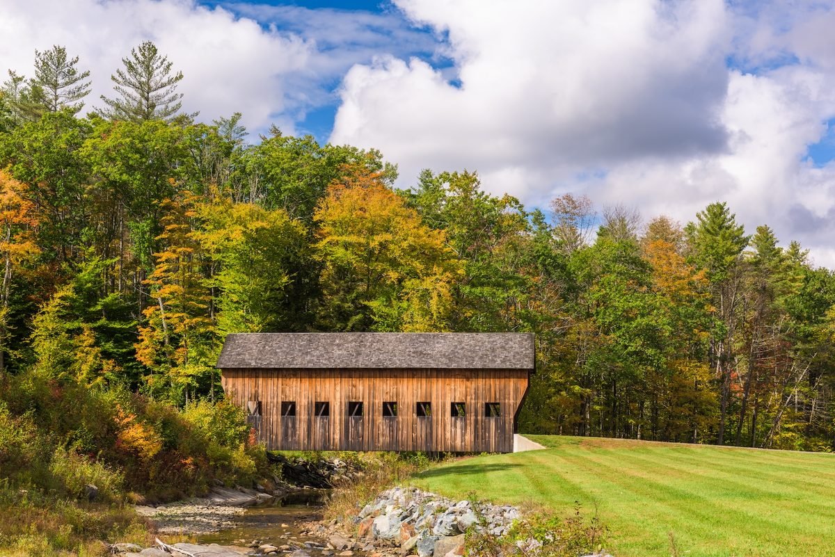
Waitsfield is a good place to leave Route 100 for a while. The Mad River Valley’s local covered bridge tour begins in historic Waitsfield Village and connects the Great Eddy, Pine Brook and Warren Village covered bridges. Along the way, country roads provide broad views toward the spine of the Green Mountains before eventually returning travelers to Route 100.
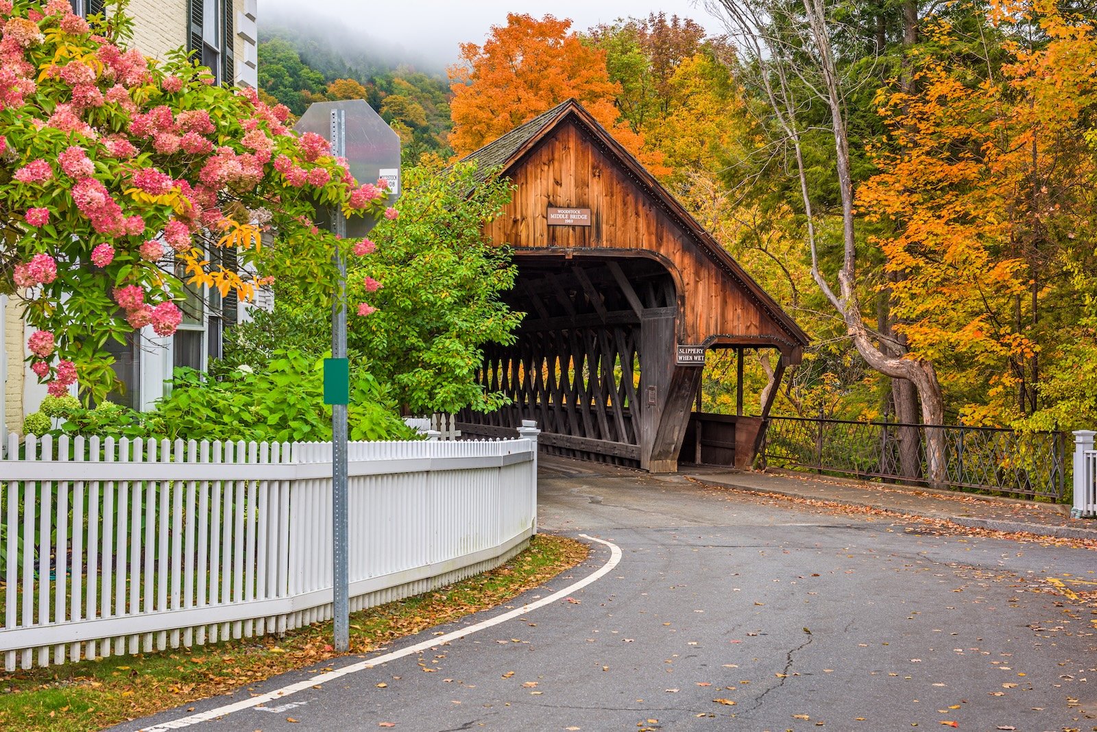
The Great Eddy Bridge is especially worth slowing down for. Built in 1833, it remains an operating covered bridge across the Mad River and is the oldest operating covered bridge in Vermont. That distinction matters because these bridges are undeniably picturesque, but they aren’t props placed beside the road for autumn photographs. In places, the road still goes through them.
Roads and rivers remain close to town. Forests and fields are visible from places where people conduct ordinary lives, and historic structures haven’t all been separated from the present and placed behind museum ropes. You can cross a covered bridge because sometimes that’s simply how you get across the river. These are communities continuing through their history rather than merely preserving the appearance of it.
Take the Back Road
The covered bridges also give us an excuse to leave the main highway. Country roads climb away from the Mad River and open toward farms and the Green Mountains beyond. The Mad River Valley’s scenic driving routes offer several possibilities, including the East Warren Loop and longer drives across the mountain gaps.
This is where slowing down changes what you notice. A field opens unexpectedly beside the road. An old barn sits below a wooded ridge. Maples begin changing around houses and along stone walls. The mountains are never entirely gone, but for a while they stop demanding all of our attention.
Farther south, Warren Village brings us back to the Mad River. Its covered bridge, village streets and surrounding mountains create one of those Vermont scenes that can look almost suspiciously well arranged, except people live here. Someone is crossing the bridge because they have somewhere to go. Someone is opening a shop or heading home. The village doesn’t exist because autumn makes it beautiful. Autumn simply makes visitors pay attention.
Where the River Runs Through Stone
Just beyond Warren, Route 100 gives us another reason to stop. Warren Falls lies along the Mad River, where water has worked its way through bedrock to form cascades and deep pools surrounded by forest. A relatively short walk from the roadside brings visitors toward a landscape that feels very different from the farms, bridges and village streets only minutes away.
Here, the river becomes wilder as water squeezes through narrow passages in the rock, tumbles between ledges and gathers in pools beneath the trees. In summer, Warren Falls is known locally as a swimming hole. By late September, however, the surrounding forest begins adding something else to the scene. Green still holds much of the canopy while yellows, oranges and occasional reds begin appearing among it, and the Mad River reflects whatever the trees are willing to give the season that day.
The falls also offer a reminder that beautiful water deserves respect. Rocks around mountain rivers can be slippery, currents and water levels change, and a pool that looks inviting shouldn’t automatically be assumed safe. There is no need to turn the stop into an adventure. Walk toward the river, find a safe place to take in the view and listen to the water moving through the stone before Route 100 calls us onward again.
A Season in the Valley
By late September, the Mad River Valley is gathering around the approaching foliage season in ways that extend beyond the forest. Art, food, markets and community events begin sharing the calendar with the changing landscape. People arrive carrying cameras to photograph mountains while those who live beneath them continue with ordinary September life. Farms keep working, shops open, children go to school, and someone crosses a covered bridge because they need to get to the other side of the river while a visitor stops because they have never seen anything quite like it.
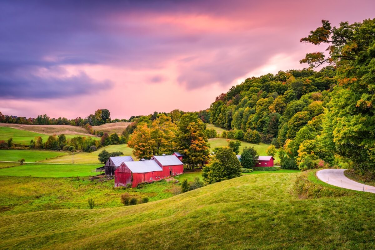
That difference is worth remembering when traveling through small communities. What feels extraordinary to a visitor may be entirely ordinary to the person who lives there. Autumn makes the distinction especially visible. Travelers may see a hillside beginning to glow red and gold, while someone living beneath it may also be thinking about the first frost, firewood, the garden, the heating season ahead or everything that needs finishing before winter. Both ways of seeing the mountain are real.
Maple Beyond the Syrup Bottle
Maple brings us back to that idea. Vermont’s maple industry sits at the intersection of agriculture and forestry. Historically, diversified farms often maintained a sugarbush alongside other agricultural work, and maple production remains connected to working forests throughout the state.
Vermont produces roughly half of the maple syrup made in the United States. That scale might suggest an industry disconnected from the small sugarhouse image, but Vermont maple production ranges across operations of very different sizes. What connects them is dependence on healthy maple forests and a particular seasonal cycle. Visitors interested in going beyond the syrup bottle can explore the Vermont Maple Meander, which connects participating sugarhouses, farms and other maple destinations around the state throughout the year.
In September, the sugarbush itself is preparing for dormancy. The chlorophyll that made the leaves green through summer begins disappearing, other pigments become visible, and the forest starts producing the colors that bring travelers north every autumn. The remarkable thing is that the spectacle and the working landscape can occupy the same trees.
A sugar maple does not know that someone has driven hundreds of miles to photograph it. It is simply moving through its year. Perhaps that’s one reason Vermont’s autumn can feel so deeply connected to the place itself. The forest isn’t merely a backdrop. It participates in the economy, traditions and seasonal rhythms of the communities beneath it.
A Little Farther South
Continuing south on Route 100 eventually brings the journey toward Killington and, beyond it, Ludlow. This part of the route gives travelers another opportunity to connect autumn with Vermont’s maple culture.
Four miles north of Ludlow, Green Mountain Sugar House sits directly along Route 100. The third-generation family business traces its sugaring history to 1955 and is open year-round, with maple syrup, maple cream, candy and other maple products connecting the trees surrounding our journey to something that can be carried home.
It is a small stop in a much larger journey, but that’s what makes it useful. The road has been carrying us through maple country for miles. Here, the connection between those trees and the food produced from them becomes tangible, and if a maple creemee happens to be part of that lesson, Vermont probably won’t object.
From here, the mountains bring another familiar thread back into our journey.
Where Two Trails Meet
The Appalachian Trail has been with us since Maine, and in Vermont we encounter an important part of its history. The Appalachian Trail and Vermont’s Long Trail share roughly 100 miles through the southern part of the state. Near Killington, at Maine Junction, the trails separate. The Long Trail continues north through the Green Mountains while the Appalachian Trail turns east toward New Hampshire.
That geography connects this week’s journey directly to the one we just completed, but Vermont’s importance to the Appalachian Trail goes deeper. Benton MacKaye, who conceived the idea that became the A.T., was influenced by Vermont’s Long Trail. The Long Trail had been established beginning in 1910, creating a footpath along the Green Mountains from Massachusetts toward Canada. MacKaye later envisioned something much larger connecting mountains along the Appalachian chain.
Last week, we met Appalachian Trail culture high in New Hampshire’s White Mountains. This week, we find part of the idea that helped make that journey possible. The trail also feels different here. New Hampshire gave us exposed ridges, high summits and mountain huts. Vermont draws us back beneath the trees, into forests beginning to change around the footpath. Autumn is no longer something we have to search for above us. We’re beginning to travel through it.
Small Towns, Big Season
It would be easy to describe Vermont’s mountain towns with a handful of familiar words: quaint, charming, picturesque. Those words aren’t necessarily wrong. They’re simply incomplete because the better explanation is found in details.
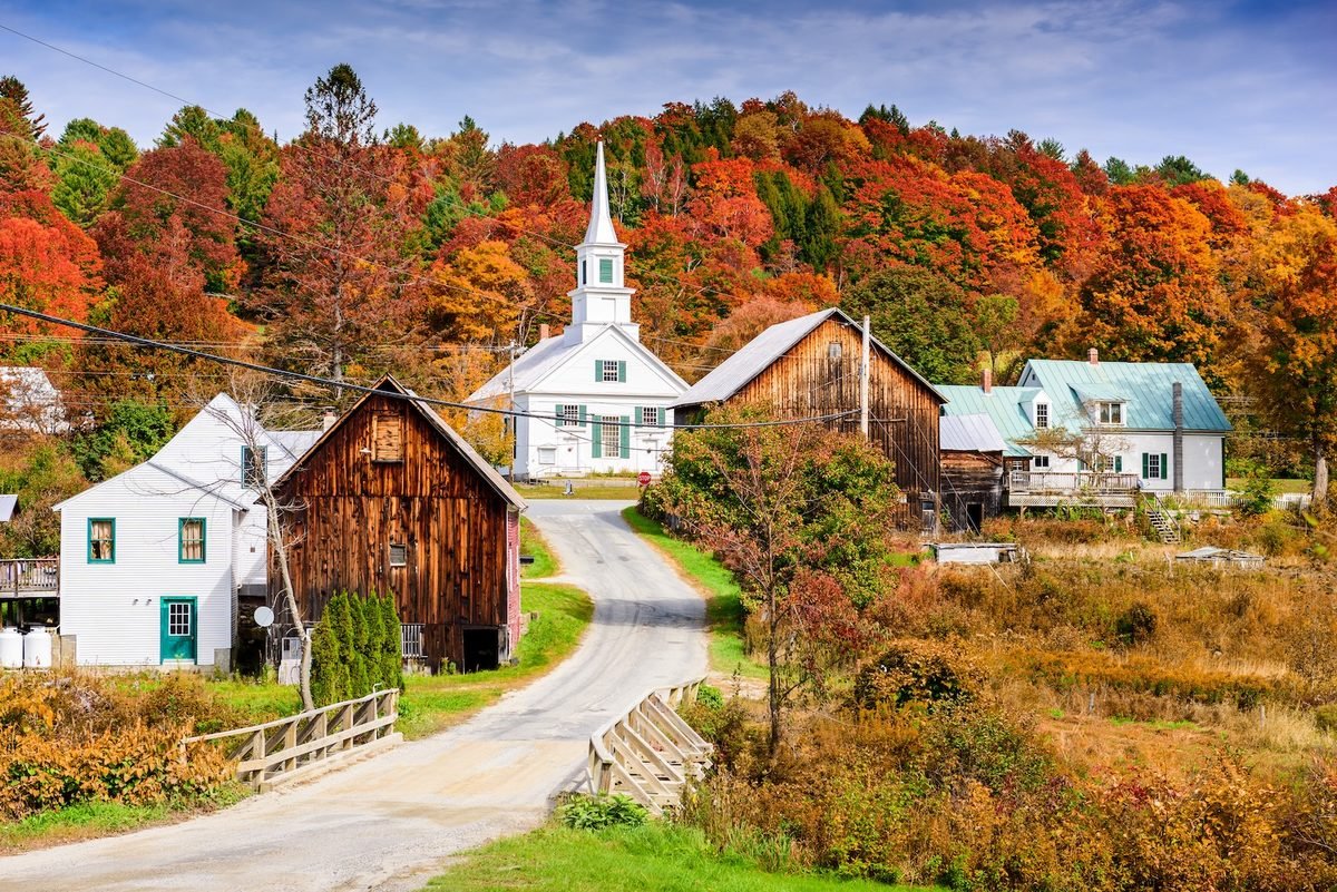
A village sits beside a river. A covered bridge still carries traffic. A farm road climbs toward a wooded ridge. Maple products come from forests visible from town. A farmers market nears the end of its season while community gatherings begin marking autumn’s arrival. A general store serves residents long after foliage visitors have gone home.
None of these things individually explains Vermont, but together they begin to. The Green Mountains provide the scale while the towns give that landscape a human dimension. They remind us that Appalachia has never been only mountains. It is also the communities that have learned how to make lives among them.
Plan Your Green Mountains Journey
Route 100 makes this journey relatively easy to follow, but some of the best parts of Vermont aren’t necessarily found by staying on it. Around Stowe, allow time for the mountain roads and surrounding countryside rather than treating the village as a single destination. In the Mad River Valley, local visitor resources provide current information on scenic drives, covered bridges, hiking, arts, farms, events and local businesses.
The local covered bridge tour connects three bridges on a manageable drive through Waitsfield and Warren. Travelers with more time can venture farther onto the valley’s back roads, while Warren Falls provides a natural stop when returning to Route 100.
For maple, use the Vermont Maple Sugar Makers’ Association directory to find producers along or near your route. Sugarhouse hours can vary considerably outside the spring sugaring season, so check current information before making a special trip.
For foliage, consult Vermont’s official weekly foliage report shortly before traveling rather than planning around a historical peak date. Elevation, tree species and weather mean autumn doesn’t move across the state according to a fixed calendar.
Give yourself more time than the mileage suggests. Vermont has a habit of making a short drive considerably longer once mountains, farm stands, bridges, waterfalls and changing maples start providing reasons to stop. Leave room for the road that looks interesting, the village where you decide to walk around or the sugarhouse you discover along the way. Those unplanned stops may be where Vermont begins feeling least like an itinerary and most like a place.
Autumn Comes Down
When we entered the White Mountains last week, we climbed to find the season. Vermont asks something different of us.
Look toward the higher slopes and autumn is becoming easier to see. Reds, oranges and yellows are beginning to spread through forests that were overwhelmingly green only weeks ago. Down in the valleys, however, summer has not vanished all at once. Farms remain green in places, trees change at different rates, and one road may feel unmistakably autumnal while another still belongs partly to September. There is no contradiction in that. This is what a season looks like while it is moving.
Soon the Green Mountains will become the Vermont people travel across the country to see. Hillsides will burn orange and red, village streets will fill with visitors, and photographs will make the landscape appear almost impossibly saturated. But we’re here before all of that, while autumn is still descending.
It moves through the higher forests first, then works its way toward the valleys, farms, rivers and towns below. The maples along one road change while others wait. The mountains begin surrendering their summer green while the communities beneath them prepare for what comes next.
In New Hampshire, we climbed until we found autumn. Here in Vermont, we can stay in the valley a little longer.
The season is coming down to meet us.