Category: Travel

Explore Appalachian destinations, scenic routes, mountain towns, historic places, and unforgettable experiences across the region.

  • Chasing Fall Through the Appalachias: Green Mountains, Vermont

    Chasing Fall Through the Appalachias: Green Mountains, Vermont

    Where Autumn Comes Down From the Mountains

    Last week, we climbed into New Hampshire’s White Mountains looking for autumn. In the valleys, summer was still holding on. Higher in the notches and along the mountain roads, yellow had begun appearing among the green, with scattered reds and oranges offering hints of what was coming. Elevation allowed us, briefly, to catch up with the season.

    This week, we turn west toward Vermont, leaving the White Mountains behind in New Hampshire as the Green Mountains rise on the other side of the Connecticut River Valley. We are still traveling through the Appalachians, but the landscape begins telling a different story. The mountains remain close, yet farms, villages and working forests become increasingly difficult to separate from them. Roads follow the valleys, pastures end where wooded slopes begin, and small towns gather along rivers and crossroads beneath mountains that determine much of the shape of life around them.

    By September 22, autumn is underway in Vermont. The state’s weekly foliage reports are already finding color in roadside trees and wetter areas, while the Upper Green Mountains have begun to turn. Reds, oranges and yellows are appearing, but plenty of green remains. That makes this an interesting time to arrive because we’re early enough to watch Vermont changing rather than simply admire it after the transformation is complete. Instead of climbing higher to find autumn, we’re going to watch it make its way down toward the places where people live.

    Following the Green Mountains

    Vermont Route 100 gives us a road to follow. Running north and south through much of the state, the highway repeatedly brings travelers back to the mountains. Around Stowe and the Upper Green Mountains, it connects communities while mountain roads lead toward Mount Mansfield, Smugglers’ Notch and the forests surrounding them.

    Yet the road itself may be more important to our journey than any single destination along it. Drive long enough and Vermont begins revealing itself in layers. Forest gives way to a farm field. A mountain appears beyond a barn. The road narrows as it enters a village and opens again on the other side. Rivers accompany portions of the journey, while side roads disappear toward places where the mountains seem to close around the valley.

    It is a journey that rewards detours, and somewhere among all of this are the trees everyone has come to see: maples.

    The Trees That Make Two Seasons

    In autumn, it is easy to think of Vermont’s maples simply as color. Sugar maples can produce some of the brilliant yellows, oranges and reds associated with a New England fall, and by late September those colors are beginning to interrupt the green forests covering the mountains. Visitors stop along roadsides to photograph them, and entire hillsides become destinations because of them.

    But in Vermont, some of those trees belong to another season entirely. When winter begins loosening its hold and nights still fall below freezing while daytime temperatures rise above it, sap begins flowing. Sugar makers tap appropriately sized maple trees and collect the clear sap that will eventually become syrup. A typical sugaring season lasts only four to six weeks, and on average it takes roughly 40 gallons of sap to produce a single gallon of maple syrup, although the amount varies.

    Child checking a metal bucket collecting maple sap from a tree
    Girl in winter hat peering into forest tree bin

    The tradition reaches much farther back than the familiar Vermont sugarhouse. Indigenous peoples of North America were making maple sugar long before European settlers arrived, and the basic relationship among tree, season, sap and heat has endured even as the technology surrounding it has changed.

    Modern sugaring can look very different from the old image of a metal bucket hanging from a tree. Tubing may carry sap through a sugarbush to collection tanks. Vacuum systems can assist collection, reverse osmosis can remove some of the water before boiling, and modern evaporators turn the remaining sap into syrup. Smaller producers may work differently, and methods vary from one sugarhouse to another, but what hasn’t changed is the dependence on the trees and the weather.

    That makes a Vermont maple forest something more than autumn scenery. The same trees attracting travelers in September will be watched for entirely different reasons when freezing nights and warmer days return near the end of winter. Travelers interested in seeing that connection firsthand can use the Vermont Maple Sugar Makers’ Association sugarhouse map to find producers throughout the state. Some welcome visitors outside the traditional spring sugaring season, although hours vary and should be checked before making a special trip.

    In September, everyone is looking at the leaves. A few months from now, Vermont will be waiting for the sap.

    Stowe Beneath the Mountains

    Stowe sits beneath Vermont’s highest mountain, Mount Mansfield, in a landscape where the Green Mountains are rarely far from view. Route 100 brings us into a community whose identity has long been intertwined with the surrounding mountains, although September arrives before winter recreation begins defining the season.

    This is the quieter interval when summer hasn’t entirely disappeared and autumn hasn’t completely taken over. The first color is spreading through the mountains while cooler mornings and evenings signal what the calendar already knows. The community calendar changes with the landscape, too, as farmers markets continue while September and early October bring arts events, festivals and seasonal gatherings.

    The individual festivals aren’t really the point. What interests us is what happens when a natural season becomes a community season. Autumn doesn’t arrive in Vermont only in the trees. It begins appearing on calendars, at markets and in the reasons people gather. The mountains change color behind town while people below them find their own ways of marking the transition.

    Before continuing south, this is also a place where taking the slower road pays off. A side trip toward Smugglers’ Notch brings travelers deeper into the mountains, while Mount Mansfield provides the enormous backdrop that helps explain why Stowe can feel less like a town beside the Green Mountains than a town within them. From here, Route 100 carries us south.

    Into the Mad River Valley

    The Mad River Valley brings together several of the threads we’ve been following. Waitsfield and Warren sit among farms, forested slopes and the Mad River, with the Green Mountains defining the horizon around them. Here, the Vermont that can so easily become a collection of postcard images begins making more sense as a lived landscape.
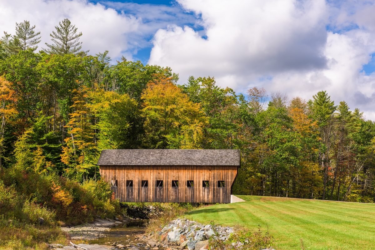
    Waitsfield is a good place to leave Route 100 for a while. The Mad River Valley’s local covered bridge tour begins in historic Waitsfield Village and connects the Great Eddy, Pine Brook and Warren Village covered bridges. Along the way, country roads provide broad views toward the spine of the Green Mountains before eventually returning travelers to Route 100.

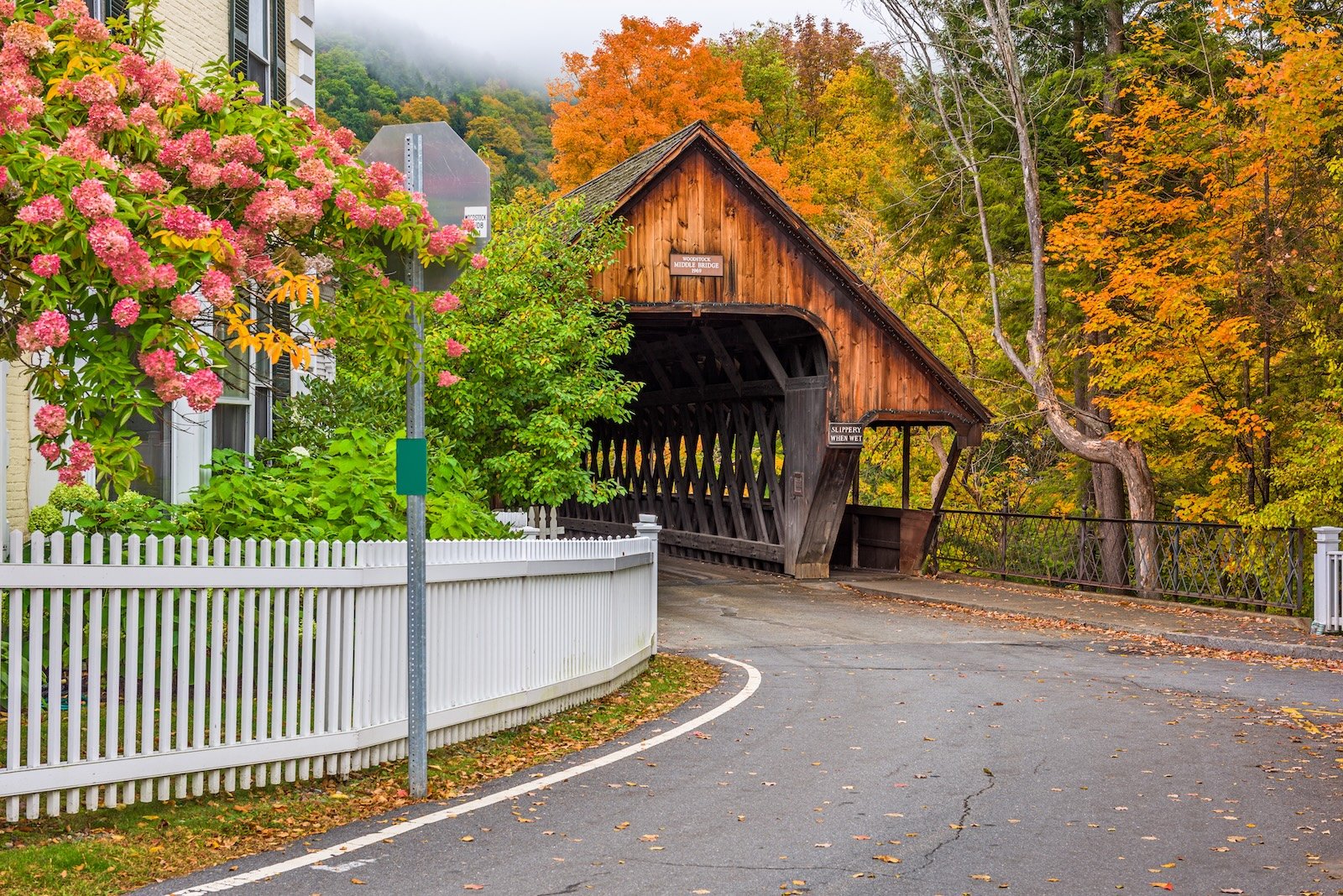
    The Great Eddy Bridge is especially worth slowing down for. Built in 1833, it remains an operating covered bridge across the Mad River and is the oldest operating covered bridge in Vermont. That distinction matters because these bridges are undeniably picturesque, but they aren’t props placed beside the road for autumn photographs. In places, the road still goes through them.

    Roads and rivers remain close to town. Forests and fields are visible from places where people conduct ordinary lives, and historic structures haven’t all been separated from the present and placed behind museum ropes. You can cross a covered bridge because sometimes that’s simply how you get across the river. These are communities continuing through their history rather than merely preserving the appearance of it.

    Take the Back Road

    The covered bridges also give us an excuse to leave the main highway. Country roads climb away from the Mad River and open toward farms and the Green Mountains beyond. The Mad River Valley’s scenic driving routes offer several possibilities, including the East Warren Loop and longer drives across the mountain gaps.

    This is where slowing down changes what you notice. A field opens unexpectedly beside the road. An old barn sits below a wooded ridge. Maples begin changing around houses and along stone walls. The mountains are never entirely gone, but for a while they stop demanding all of our attention.

    Farther south, Warren Village brings us back to the Mad River. Its covered bridge, village streets and surrounding mountains create one of those Vermont scenes that can look almost suspiciously well arranged, except people live here. Someone is crossing the bridge because they have somewhere to go. Someone is opening a shop or heading home. The village doesn’t exist because autumn makes it beautiful. Autumn simply makes visitors pay attention.

    Where the River Runs Through Stone

    Just beyond Warren, Route 100 gives us another reason to stop. Warren Falls lies along the Mad River, where water has worked its way through bedrock to form cascades and deep pools surrounded by forest. A relatively short walk from the roadside brings visitors toward a landscape that feels very different from the farms, bridges and village streets only minutes away.

    Here, the river becomes wilder as water squeezes through narrow passages in the rock, tumbles between ledges and gathers in pools beneath the trees. In summer, Warren Falls is known locally as a swimming hole. By late September, however, the surrounding forest begins adding something else to the scene. Green still holds much of the canopy while yellows, oranges and occasional reds begin appearing among it, and the Mad River reflects whatever the trees are willing to give the season that day.

    The falls also offer a reminder that beautiful water deserves respect. Rocks around mountain rivers can be slippery, currents and water levels change, and a pool that looks inviting shouldn’t automatically be assumed safe. There is no need to turn the stop into an adventure. Walk toward the river, find a safe place to take in the view and listen to the water moving through the stone before Route 100 calls us onward again.

    A Season in the Valley

    By late September, the Mad River Valley is gathering around the approaching foliage season in ways that extend beyond the forest. Art, food, markets and community events begin sharing the calendar with the changing landscape. People arrive carrying cameras to photograph mountains while those who live beneath them continue with ordinary September life. Farms keep working, shops open, children go to school, and someone crosses a covered bridge because they need to get to the other side of the river while a visitor stops because they have never seen anything quite like it.
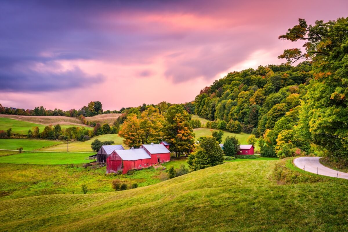
    Red barns and rolling farmland surrounded by early fall foliage in rural Vermont
    Red barns sit among rolling fields and forests beginning to turn, as autumn settles into Vermont’s rural landscape.

    That difference is worth remembering when traveling through small communities. What feels extraordinary to a visitor may be entirely ordinary to the person who lives there. Autumn makes the distinction especially visible. Travelers may see a hillside beginning to glow red and gold, while someone living beneath it may also be thinking about the first frost, firewood, the garden, the heating season ahead or everything that needs finishing before winter. Both ways of seeing the mountain are real.

    Maple Beyond the Syrup Bottle

    Maple brings us back to that idea. Vermont’s maple industry sits at the intersection of agriculture and forestry. Historically, diversified farms often maintained a sugarbush alongside other agricultural work, and maple production remains connected to working forests throughout the state.

    Vermont produces roughly half of the maple syrup made in the United States. That scale might suggest an industry disconnected from the small sugarhouse image, but Vermont maple production ranges across operations of very different sizes. What connects them is dependence on healthy maple forests and a particular seasonal cycle. Visitors interested in going beyond the syrup bottle can explore the Vermont Maple Meander, which connects participating sugarhouses, farms and other maple destinations around the state throughout the year.

    In September, the sugarbush itself is preparing for dormancy. The chlorophyll that made the leaves green through summer begins disappearing, other pigments become visible, and the forest starts producing the colors that bring travelers north every autumn. The remarkable thing is that the spectacle and the working landscape can occupy the same trees.

    A sugar maple does not know that someone has driven hundreds of miles to photograph it. It is simply moving through its year. Perhaps that’s one reason Vermont’s autumn can feel so deeply connected to the place itself. The forest isn’t merely a backdrop. It participates in the economy, traditions and seasonal rhythms of the communities beneath it.

    A Little Farther South

    Continuing south on Route 100 eventually brings the journey toward Killington and, beyond it, Ludlow. This part of the route gives travelers another opportunity to connect autumn with Vermont’s maple culture.

    Four miles north of Ludlow, Green Mountain Sugar House sits directly along Route 100. The third-generation family business traces its sugaring history to 1955 and is open year-round, with maple syrup, maple cream, candy and other maple products connecting the trees surrounding our journey to something that can be carried home.

    It is a small stop in a much larger journey, but that’s what makes it useful. The road has been carrying us through maple country for miles. Here, the connection between those trees and the food produced from them becomes tangible, and if a maple creemee happens to be part of that lesson, Vermont probably won’t object.

    From here, the mountains bring another familiar thread back into our journey.

    Where Two Trails Meet

    The Appalachian Trail has been with us since Maine, and in Vermont we encounter an important part of its history. The Appalachian Trail and Vermont’s Long Trail share roughly 100 miles through the southern part of the state. Near Killington, at Maine Junction, the trails separate. The Long Trail continues north through the Green Mountains while the Appalachian Trail turns east toward New Hampshire.

    That geography connects this week’s journey directly to the one we just completed, but Vermont’s importance to the Appalachian Trail goes deeper. Benton MacKaye, who conceived the idea that became the A.T., was influenced by Vermont’s Long Trail. The Long Trail had been established beginning in 1910, creating a footpath along the Green Mountains from Massachusetts toward Canada. MacKaye later envisioned something much larger connecting mountains along the Appalachian chain.

    Last week, we met Appalachian Trail culture high in New Hampshire’s White Mountains. This week, we find part of the idea that helped make that journey possible. The trail also feels different here. New Hampshire gave us exposed ridges, high summits and mountain huts. Vermont draws us back beneath the trees, into forests beginning to change around the footpath. Autumn is no longer something we have to search for above us. We’re beginning to travel through it.

    Small Towns, Big Season

    It would be easy to describe Vermont’s mountain towns with a handful of familiar words: quaint, charming, picturesque. Those words aren’t necessarily wrong. They’re simply incomplete because the better explanation is found in details.
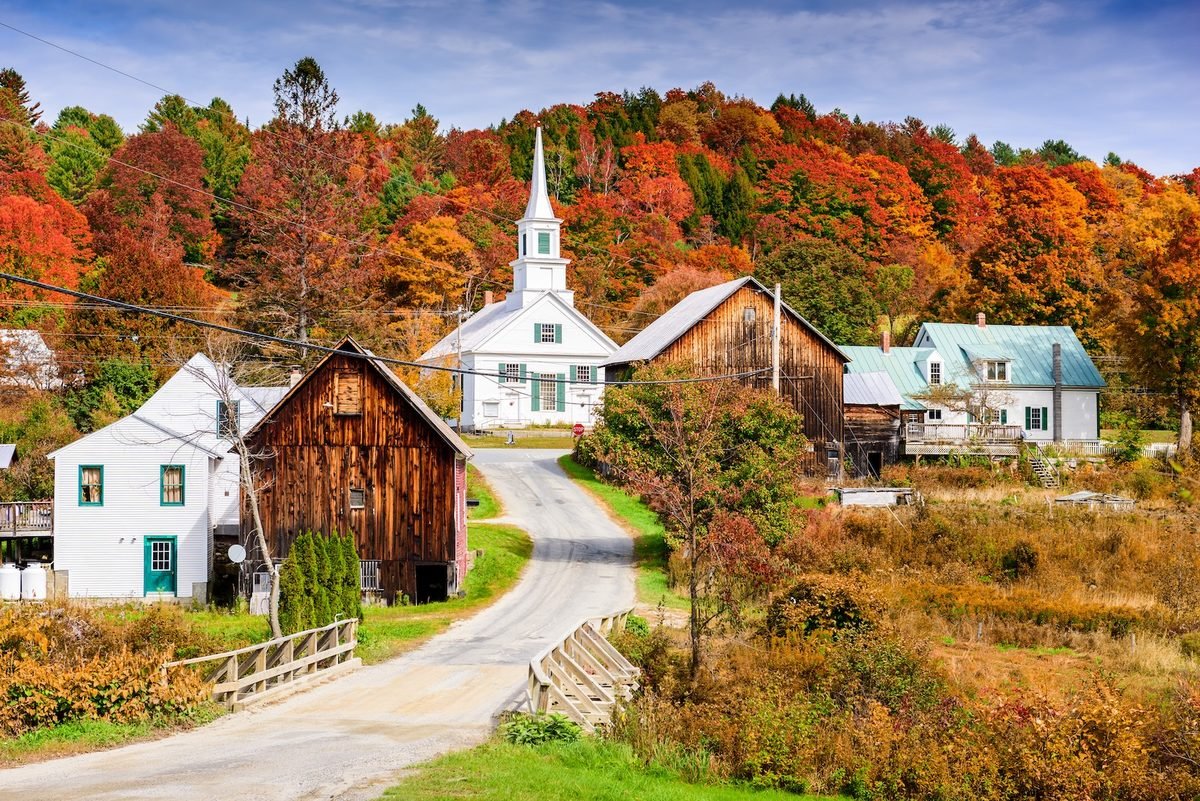
    Rural Vermont, USA autumn foliage.

    A village sits beside a river. A covered bridge still carries traffic. A farm road climbs toward a wooded ridge. Maple products come from forests visible from town. A farmers market nears the end of its season while community gatherings begin marking autumn’s arrival. A general store serves residents long after foliage visitors have gone home.

    None of these things individually explains Vermont, but together they begin to. The Green Mountains provide the scale while the towns give that landscape a human dimension. They remind us that Appalachia has never been only mountains. It is also the communities that have learned how to make lives among them.

    Plan Your Green Mountains Journey

    Route 100 makes this journey relatively easy to follow, but some of the best parts of Vermont aren’t necessarily found by staying on it. Around Stowe, allow time for the mountain roads and surrounding countryside rather than treating the village as a single destination. In the Mad River Valley, local visitor resources provide current information on scenic drives, covered bridges, hiking, arts, farms, events and local businesses.

    The local covered bridge tour connects three bridges on a manageable drive through Waitsfield and Warren. Travelers with more time can venture farther onto the valley’s back roads, while Warren Falls provides a natural stop when returning to Route 100.

    For maple, use the Vermont Maple Sugar Makers’ Association directory to find producers along or near your route. Sugarhouse hours can vary considerably outside the spring sugaring season, so check current information before making a special trip.

    For foliage, consult Vermont’s official weekly foliage report shortly before traveling rather than planning around a historical peak date. Elevation, tree species and weather mean autumn doesn’t move across the state according to a fixed calendar.

    Give yourself more time than the mileage suggests. Vermont has a habit of making a short drive considerably longer once mountains, farm stands, bridges, waterfalls and changing maples start providing reasons to stop. Leave room for the road that looks interesting, the village where you decide to walk around or the sugarhouse you discover along the way. Those unplanned stops may be where Vermont begins feeling least like an itinerary and most like a place.

    Autumn Comes Down

    When we entered the White Mountains last week, we climbed to find the season. Vermont asks something different of us.

    Look toward the higher slopes and autumn is becoming easier to see. Reds, oranges and yellows are beginning to spread through forests that were overwhelmingly green only weeks ago. Down in the valleys, however, summer has not vanished all at once. Farms remain green in places, trees change at different rates, and one road may feel unmistakably autumnal while another still belongs partly to September. There is no contradiction in that. This is what a season looks like while it is moving.

    Soon the Green Mountains will become the Vermont people travel across the country to see. Hillsides will burn orange and red, village streets will fill with visitors, and photographs will make the landscape appear almost impossibly saturated. But we’re here before all of that, while autumn is still descending.

    It moves through the higher forests first, then works its way toward the valleys, farms, rivers and towns below. The maples along one road change while others wait. The mountains begin surrendering their summer green while the communities beneath them prepare for what comes next.

    In New Hampshire, we climbed until we found autumn. Here in Vermont, we can stay in the valley a little longer.

    The season is coming down to meet us.
  • Chasing Fall Through the Appalachias: White Mountains, New Hampshire

    Chasing Fall Through the Appalachias: White Mountains, New Hampshire

    Climbing Toward Autumn

    Last week, we left Western Maine before the show. The mountains surrounding Rangeley and Bigelow were still largely green, though the first scattered reds and yellows had begun to betray the season ahead. Autumn was moving through Appalachia, but quietly enough that you had to pay attention to find it.

    Now we cross into New Hampshire, where the landscape changes and our pursuit of fall changes with it. The White Mountains rise higher, the roads climb more dramatically, and the Appalachian Trail enters some of the most demanding terrain on its long journey north. Here, elevation complicates the calendar. Summer can linger in a valley while the upper slopes have already begun moving toward another season.

    As of September 15, the White Mountains Foliage Tracker places the region at about 10 percent color. Green still dominates the hillsides, but orange and yellow have begun creeping into lower elevations. Franconia and Pinkham notches are showing yellow higher on the mountains, while portions of the Kancamagus Highway have begun picking up red, orange and yellow, particularly toward its western end and higher ground.

    We are still weeks away from the color that will eventually cover these mountains. Historically, the White Mountains reach their most brilliant foliage during the first two weeks of October. But peak color was never the point of this journey. We’re following autumn as it moves, and in New Hampshire, we’re going higher to meet it.

    Into Franconia Notch

    The road into Franconia Notch State Park wastes little time introducing the White Mountains. Interstate 93 narrows as it enters the pass, with the Franconia Range rising to the east and the Kinsman Range to the west. What appears on a map to be a highway through the mountains begins to feel much more like a road allowed passage between them.

    This is part of the White Mountains Trail, a scenic route connecting Franconia Notch with Crawford Notch, the Kancamagus Highway and other landscapes across the region. It would be possible to spend the day following the road from viewpoint to viewpoint, but it would also be a shame never to step away from it.

    Franconia Notch offers mountain lakes, trails, waterfalls and the unmistakable profile of Cannon Mountain rising above the valley. Near the southern end of the park, however, the landscape draws inward. There, water has opened a passage through stone.

    Inside the Flume

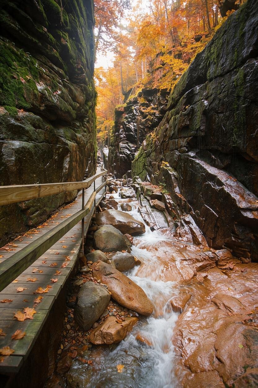
    At Flume Gorge, the enormous scale of the White Mountains suddenly becomes intimate. The natural gorge extends roughly 800 feet along the base of Mount Liberty. Walls of Conway granite rise 70 to 90 feet and, at their narrowest, stand only 12 feet apart. A wooden boardwalk follows Flume Brook through the gorge, passing among ferns, mosses and flowers growing in the damp shelter of the rock walls. At the upper end, Avalanche Falls drops about 45 feet into the gorge.

    It is a very different way to encounter these mountains. Much of what makes the White Mountains famous is enormous: long ridges, high summits and views stretching across miles of forest. Inside the Flume, your attention is pulled closer. Water moves around boulders, ferns spill from cracks in the granite, moss softens stone that otherwise looks immovable, and the boardwalk disappears ahead between walls shaped by water and time.

    In mid-September, much of this forest is still green, and that feels right. We are not seeing autumn after it has finished transforming the landscape. We’re watching the transformation happen. A yellow leaf among green ones matters here, as does a maple somewhere above the rock beginning to change ahead of its neighbors.

    Sometimes a season announces itself across an entire mountainside. Sometimes it starts with one tree.

    The Mountain With the Missing Face

    There is another story written into the stone of Franconia Notch. For generations, five granite ledges high on Cannon Mountain aligned from below to create the profile of a man’s face.

    The Old Man of the Mountain became an emblem of New Hampshire, appearing on license plates, road signs and the state’s quarter. Then, sometime during the night of May 3, 2003, the formation collapsed. People woke to discover that a face seemingly carved into the mountain had disappeared.

    Today, the Old Man of the Mountain Profile Plaza looks toward the cliff where the Old Man once appeared. Steel profilers allow visitors standing in the correct position to recreate the familiar outline against the mountain.

    There is something strangely appropriate about encountering that story while chasing autumn. We speak about mountains as though they are permanent and seasons as though they are fleeting, but the mountains change too. We simply aren’t always here long enough to watch.

    Across the Kancamagus

    From Lincoln, Route 112 begins one of the best-known drives in New England. The Kancamagus Highway travels 34.5 miles through the White Mountain National Forest between Lincoln and Conway. Through its mountain section there are no restaurants, hotels, gas stations or commercial strips interrupting the forest.

    The Swift River follows portions of the road, trailheads disappear beneath the trees, and overlooks open toward mountains that will soon become the subject of countless autumn photographs. Today, however, most of them are still green.

    This is where it becomes tempting to hurry the season, but there is no reason to. The September 15 foliage report is already finding red, orange and yellow along the Kanc, particularly toward the western end and around the height of land, yet the region overall remains only about 10 percent changed.

    The famous October landscape exists here now only in pieces. One hillside has begun to change while another waits. Color gathers around a wetland or appears beside the river. A tree glowing red among hundreds still wearing summer green can attract more attention than an entire red hillside will a few weeks from now.

    Perhaps that’s because right now every changing tree seems to be telling us the same thing.

    It’s coming.

    Through Crawford Notch

    Another road carries us deeper into the mountains. Route 302 passes through Crawford Notch State Park, where steep mountains close around the valley and trails lead toward waterfalls, lakes and high ridges.

    There are ambitious ways to explore this country, and there are quiet ones. A traveler can walk near Saco Lake, stop for a view of Silver Cascade or simply follow the road through the notch while mountains rise on either side.

    That distinction matters in a place celebrated for strenuous hiking. The White Mountains deserve respect. Their trails climb serious terrain, and conditions at elevation can change quickly. But these mountains do not belong only to the people capable of climbing to their summits. You can hike a ridge, walk beside a lake, follow a boardwalk through a gorge or pull safely off the road at an overlook and stand there as long as you please.

    There is no requirement that beauty be earned through exhaustion.

    Autumn settles into Flume Gorge, where a wooden boardwalk follows the rushing water between towering granite walls in Franconia Notch State Park.

    Mount Washington

    Eventually, the mountains lead toward one that seems to exist on a different scale. Mount Washington State Park occupies the summit of the highest peak in the Northeast, 6,288 feet above sea level. On a clear day, the view can extend more than 100 miles across New England and beyond.

    The view is only part of what makes the mountain remarkable. Elevation strips the familiar landscape away as you climb. Forest changes, trees grow shorter, and eventually the sheltered world below gives way to exposed high country where weather can be dramatically different from conditions in the valley.

    In a journey following autumn, that climb gives us something unusual. We can move through the season vertically.

    The Mount Washington Auto Road has carried travelers up the eastern side of the mountain since 1861, while the Mount Washington Cog Railway climbs from the west. Hiking trails provide another route, though reaching the summit on foot is a serious mountain undertaking rather than a casual autumn walk.

    Whichever way you experience the mountain, the lesson is similar. Down below, September may still look like summer. Keep climbing and the illusion becomes harder to maintain. Cold arrives sooner up here, and so does autumn.

    A Trail Through the High Country

    The Appalachian Trail has been accompanying us since this journey began in Maine. In the White Mountains, its personality changes.

    Here, the trail crosses exposed ridges and high summits, including some of the most demanding terrain along the entire route from Georgia to Maine. The forest that shelters hikers farther south sometimes falls away, leaving rock, sky and rapidly changing mountain weather. It is also here that the trail intersects with a tradition distinctive to the White Mountains: the mountain huts.

    The Appalachian Mountain Club operates a network of backcountry huts reached on foot throughout the region. Some sit within the forest. Others occupy the high country where the landscape has already left most trees behind.

    Lakes of the Clouds Hut sits at 5,012 feet below Mount Monroe. Reaching it from the Ammonoosuc Ravine Trailhead requires a strenuous three-mile climb, and its 2026 full-service season continues through September 19. A little farther north in the Presidential Range, Madison Spring Hut sits at 4,600 feet between Mount Adams and Mount Madison, with its full-service season continuing through September 26.

    These aren’t hotels that happen to have mountain views. You have to walk to them, and that changes their place in the landscape. Hikers arrive from different directions and for different reasons. Some are traveling the Appalachian Trail toward Maine. Others are crossing the Presidential Range, climbing a summit or spending a few days in the mountains.

    For a night, their paths meet. Morning sends them apart again.

    There is something fitting about that temporary community in the Appalachians: people gathering in an isolated place, sharing shelter and a meal, trading pieces of their journeys and then continuing down separate paths. The huts belong to the mountains, but they also belong to the human story of walking through them.

    The Communities Below

    Eventually, everyone has to come down. The valleys beneath the White Mountains are dotted with communities that have spent generations living alongside people arriving to hike, ski, fish, sightsee, ride trains, climb mountains or simply disappear into the woods for a few days.

    Lincoln and North Woodstock sit near the western end of the Kancamagus. Franconia and Sugar Hill lie beyond the notch, while North Conway and Jackson sit on the eastern side of the mountains. These communities give the journey a human scale.

    A bakery after a cold morning outside doesn’t need to be famous to become memorable. Neither does an old inn, a cup of cider or a table somewhere near a window when the light begins disappearing from the mountains. This is where local businesses belong in our journey, not as attractions competing with the landscape, but as part of the communities living beneath it.

    Stay somewhere small if that suits you. Eat somewhere local. Wander through a village rather than driving directly to the next overlook. The mountains tell only part of the story of the White Mountains. People have been making lives beneath them for a very long time.

    When Fall Reaches the Towns

    By September, the changing season begins appearing in ways that have nothing to do with foliage reports. Apples return, cider follows, and cool evenings make a warm meal feel different than it did in August. Farm stands begin looking like autumn even when the mountains behind them don’t.

    The calendar starts changing too. On September 15, the regional events calendar marks the opening of Much Ado About Nothing at the Weathervane Theatre, one reminder that a day in the White Mountains does not have to end when the trail does.

    These details are easy to overlook when the mountains are demanding attention, but they are also part of what we’re following. Autumn is more than chlorophyll disappearing from leaves. It changes what people eat, what they wear, what happens in town and how early everyone notices the evening arriving.

    The mountains may not yet look like October, but the communities beneath them already know October is coming.

    Before the Mountains Burn Bright

    If you came to the White Mountains this week expecting entire mountainsides covered in red, orange and gold, you arrived early. For our journey, you arrived at exactly the right time.

    The White Mountains are at roughly 10 percent color. Franconia and Pinkham notches are beginning to show yellow at higher elevations. The western Kancamagus is picking up scattered reds, oranges and yellows, while most of the landscape remains green.

    In another few weeks, much of this will be transformed. The White Mountains typically reach their strongest color during the first two weeks of October, although elevation, tree species and weather ensure that no single date can promise peak foliage everywhere.

    Come then and the mountains may give you the grand spectacle. Come now and they give you something else: the beginning.

    There is a peculiar pleasure in recognizing a season before it becomes impossible to miss.

    Plan Your White Mountains Journey

    The White Mountains Visitors Center is a useful starting point for current information on scenic drives, lodging, attractions, events and recreation throughout the region.

    If foliage is part of the reason for your trip, check both New Hampshire’s official Fall Foliage Tracker and the regional White Mountains Foliage Tracker shortly before leaving. Both are more useful than planning around a historical peak date because the season progresses differently each year.

    For hikers, the Appalachian Mountain Club provides information on trails, huts and backcountry planning. AMC also operates a White Mountains hiker shuttle on selected days into October, although its schedule should be checked before relying on it for transportation.

    For Mount Washington, check current operating conditions directly with the Mount Washington Auto Road or Mount Washington Cog Railway. Summit conditions can be dramatically different from the weather below, so mountain forecasts deserve attention even when the valley looks perfectly inviting.

    If you plan to visit the Flume, check current information through New Hampshire State Parks before setting out. The complete loop is about two miles and includes uphill walking, boardwalks and numerous stairs, and advance reservations are recommended because entry windows can sell out.

    Once the practical planning is finished, leave a little of the trip unplanned. Follow the road through one more notch, stop beside the river, walk into the woods or find somewhere warm when you’re hungry.

    And if the mountains are greener than the photograph you imagined before you came, don’t be disappointed.

    Look closer.

    Chasing Fall South

    We entered the White Mountains looking for autumn. At first, summer seemed reluctant to let it through. Green still covered the valleys, the forests around the Flume remained lush, and from a distance many of the mountains looked much as they had weeks before.

    Then we began to climb. Yellow appeared higher in the notches. Red and orange interrupted the green along the Kancamagus. The air changed as the road gained elevation, and somewhere above the trees, the high country had already moved farther into the season than the valleys below.

    For a little while, we caught up.

    But autumn is still moving. Behind us, Maine is turning. Soon the White Mountains will follow, and the scattered color we see today will spread across slopes that are still green.

    We won’t be here when that happens. We’re chasing fall south, and the mountains ahead are waiting.

  • Chasing Fall Through the Appalachias: Western Maine

    Chasing Fall Through the Appalachias: Western Maine

    Where Autumn Takes the Back Roads

    Autumn has begun its journey through Appalachia, but it is in no hurry.

    Last week, we began beneath the shadow of Katahdin, where the first hints of color were appearing across the northern Maine wilderness. Now we turn southwest, following the mountains toward Rangeley, Carrabassett Valley and the long ridges of Bigelow, into a part of Maine where September still belongs partly to summer.

    The forests are mostly green. The lakes still reflect mountains wearing their summer colors, and warm afternoons can make autumn seem farther away than it really is. Then comes a cool morning, a maple touched with red along the roadside, or a streak of yellow appearing on a distant slope.

    The season is here. It simply hasn’t announced itself loudly yet.

    That is part of the pleasure of chasing fall rather than waiting for peak foliage. Autumn is not something that happens to the mountains overnight. It gathers slowly, almost tree by tree, until one day the landscape we thought we knew has become something entirely different.

    In Western Maine, we have arrived in time to watch it begin.

    The Road Into Rangeley

    There are places best discovered after you leave the fastest road behind.

    The Rangeley Lakes region is one of them.

    Here, lakes stretch beneath wooded mountains, roads rise and fall with the land, and the Appalachian landscape seems to open a little farther with every bend. Rangeley sits among six large lakes and hundreds of smaller ponds and waterways, with mountains rising beyond them and the Appalachian Trail crossing the surrounding high country.

    The Rangeley Lakes National Scenic Byway offers one of the loveliest ways into this landscape. It winds through mountain and lake country where the temptation to keep driving competes constantly with the temptation to pull over.

    Eventually, there is one place where you should.

    On Route 17, Height of Land overlooks Mooselookmeguntic Lake and Upper Richardson Lake, their long blue waters reaching between mountains and forested ridges.

    It is an enormous view.

    In October, people come here for hillsides washed in red, orange and gold. But early September offers something quieter. Green still claims most of the mountains, while the first changing trees appear almost like brushstrokes across the landscape.

    Stand here long enough and it becomes easier to understand what we are chasing.

    Not simply color, but change.

    Stay Awhile in Rangeley

    Rangeley is the kind of mountain town that gives you reasons to put away the itinerary for a while.

    The lakes have drawn people here for generations, particularly anglers, but there are plenty of ways to experience the region without ever casting a line. Hiking trails disappear into the surrounding woods. Canoes and kayaks slip onto quiet water. Roads wander toward overlooks, ponds and mountains that seem to invite one more detour.

    At nearly 900 acres, Rangeley Lake State Park stretches along the southern shore of Rangeley Lake and offers camping, boating, swimming and access to the water. It can also be something much simpler: a place to sit beside a Maine lake and watch the mountains on the opposite shore.

    Rangeley’s history as a destination is still visible around those lakes. Generations before foliage reports helped travelers time an autumn drive, sporting camps were bringing visitors into Western Maine to fish, hunt and spend time in the woods.

    Near Oquossoc, Bald Mountain Camps grew from that tradition. Its history reaches into the 1800s, and today the second-generation family-run property has just 14 log cabins. Private porches, fireplaces or wood stoves keep some of the character of the old Maine sporting-camp experience intact.

    Along the northeastern shore of Rangeley Lake, North Camps takes a similarly small-scale approach. Thirteen rustic cabins sit across 20 wooded acres, with screened porches, wood stoves, a private beach and canoes and kayaks available for guests. The camps remain open into the fall hunting season, when September’s cool nights begin giving way to the colder days ahead.

    And on Rangeley Lake, Loon Lodge Inn & Restaurant occupies a restored lodge that has been welcoming guests since 1899. Today it combines guest rooms with a restaurant and pub overlooking the lake. During the warmer season, boaters can even arrive from the water to dock and dine.

    None of these places is necessary to experience Rangeley, and they are far from the region’s only choices. But together they preserve something interesting about the way people have long traveled here.

    The mountains are not scenery you return to after leaving your hotel in the morning. In places like these, the lake and woods remain just outside the door.

    The Rangeley Lakes Region Chamber of Commerce maintains current information on these and other lodging options throughout the area.

    A Town Between the Lakes and Mountains

    It would be easy to come to Rangeley, photograph the scenery and keep driving.

    It would also mean missing part of the place.

    Downtown, older buildings continue to serve new generations. Furbish Brew House & Eats occupies a restored 1912 building where original wood trim and hutches remain. A brick oven built inside by a Maine artist now turns out wood-fired pizzas, and the building is also home to Rangeley’s first brewery.

    That mixture of old and new feels appropriate here. Western Maine carries its history without needing to freeze itself inside it.

    For something simpler in the morning, Classic Provisions operates as a small café, breakfast and sandwich stop, and gourmet market on Main Street. On Thursdays, its back parking lot becomes the Downtown Farmers Market from 10 a.m. to 2 p.m., bringing together organic produce and meats, locally made products and work from area artists.

    On Tuesdays, the South Shore Drive Farmers Market offers another opportunity to encounter the region beyond its overlooks.

    A farmers market may seem like a small thing beside a mountain range, but that is partly why it matters.

    These mountains are not an empty wilderness arranged for visitors. People live here, make things here, grow food here and gather here.

    The mountains may bring you to Rangeley, but the community tells you where you are.

    Walk With Someone Who Knows the Country

    September also offers opportunities to get out of the car and experience the landscape more closely.

    The Rangeley region’s T.R.A.C. program organizes guided hikes and paddles on Tuesdays and Fridays with local volunteer leaders familiar with the routes they lead. On September 8, the date of this stop on our Chasing Fall journey, both T.R.A.C. and the South Shore Drive Farmers Market were on the local calendar.

    There is something fitting about that.

    You can certainly explore Western Maine independently. But walking a trail or paddling a stretch of water with someone familiar with the country can reveal things easily missed when the goal is simply reaching the next viewpoint.

    For travelers following this journey later in the season, the Rangeley Region events calendar is worth checking before a visit. Markets, guided outings and seasonal events change throughout the year.

    Stories Behind the Scenery

    Near Rangeley in Oquossoc, the Outdoor Heritage Museum offers another way to understand why these lakes and mountains have drawn people for so long.

    Its collections explore the region’s outdoor history, including guides, sporting traditions and the people whose lives became connected to the woods and waters of Western Maine. That history helps place the old camps around Rangeley in a larger story.

    On September 19, the museum holds its Fall Festival, with Maine arts, crafts and antiques vendors gathering on the museum grounds as cooler weather begins settling over the region.

    For travelers whose dates happen to align, a small local festival can become an unexpected part of an autumn trip. For everyone else, the museum offers something equally valuable: context.

    Scenery becomes richer when you begin learning the stories held inside it.

    Deeper Into the Western Mountains

    Eventually, the road calls again.

    South and east of Rangeley, Route 27 follows the mountains through Kingfield and Carrabassett Valley, where the Carrabassett River threads through a valley surrounded by some of Maine’s highest country. Mount Abraham rises nearby. Sugarloaf dominates part of the skyline. Beyond it waits the unmistakable profile of the Bigelow Range.

    The Maine Appalachians feel bigger here.

    Carrabassett Valley is well known as the home of Sugarloaf, but winter is only one chapter in the life of these mountains. Hiking and mountain biking trails spread through the valley and surrounding forests. The Appalachian Trail crosses the high country nearby, while Maine Huts & Trails reaches through the backcountry toward Flagstaff Lake.

    If hunger catches up somewhere along the way, The Bag & Kettle has been part of Carrabassett Valley for decades. It is one of those longstanding local stops that can simply become part of a day spent moving through the mountains rather than a destination around which the day needs to be built.

    Because the landscape is still the reason we came.

    In September, there is a particular pleasure in driving these mountain roads before autumn reaches its crescendo. A hillside can appear almost entirely green from a distance, only to reveal scattered red maples as the road draws closer. Higher slopes begin changing on a different schedule from sheltered valleys, and morning fog may hide a ridge that appears again beneath blue sky an hour later.

    The mountains reveal themselves gradually.

    So does the season.

    Beneath the Bigelow Range

    Then Bigelow Preserve appears.

    The preserve surrounding it protects more than 36,000 acres of mountain wilderness, including the entire Bigelow Range and seven summits. West Peak rises to 4,150 feet, placing it among Maine’s ten summits above 4,000 feet. To the north, the mountains descend toward the broad waters of Flagstaff Lake.

    The Appalachian Trail crosses the range on its long journey toward Katahdin.

    For experienced hikers prepared for mountain terrain, Bigelow offers the opportunity to climb into a landscape where ridges seem to roll away toward the horizon. The high country is beautiful, but it should be approached with respect. Weather changes, distances are real, and a mountain that looks inviting from the valley remains a mountain once you begin climbing it.

    Fortunately, Bigelow does not reserve its beauty for those who reach the summit.

    Travelers can experience the range from Route 27 through Carrabassett Valley, from Cathedral Pines in Eustis and from the overlook on Eustis Ridge. Each offers a different relationship with the mountains.

    There is no single correct way to experience Appalachia. Some of us meet a mountain by climbing it. Others follow the road beneath it, stop at an overlook, walk a gentler trail or simply stand somewhere beautiful and look up.

    The mountain does not ask how you arrived.

    Where the Mountains Meet the Water

    On the northern side of Bigelow, the landscape changes again.

    Flagstaff Lake spreads beneath the mountains, giving travelers the chance to look back toward the Bigelow Range from the water. From a canoe or kayak, the scale of the mountains becomes apparent in a different way. Forest rises from the shoreline toward the ridges, and the long mountain profile follows the lake.

    As September deepens into October, that forest will become part of the spectacle.

    Imagine paddling across cool water while autumn climbs the mountains ahead of you, the shoreline beginning to glow with yellow and red and the higher ridges rising beyond it.

    For now, the transformation is subtler.

    Flagstaff is also part of the Northern Forest Canoe Trail, a 740-mile paddling route connecting waterways across New York, Vermont, Quebec, New Hampshire and Maine. Visitors do not need to undertake anything remotely that ambitious to appreciate this stretch of it. Even a much smaller encounter with the lake can change the way you see Bigelow.

    For travelers wanting to move deeper into the landscape, Maine Huts & Trails maintains a trail and hut system connecting parts of Carrabassett Valley and the Flagstaff Lake region. Reaching the huts requires human-powered travel rather than simply driving to the door, making them an option for those wanting to leave the road behind for a while.

    Some places ask you to slow down before they reveal very much.

    Western Maine is one of them.

    Before the Mountains Turn

    If you come to Western Maine in early September expecting mountains blazing with peak foliage, you have arrived too soon.

    But perhaps not at the wrong time.

    Western Maine generally reaches peak fall color around the second week of October. In early September, much of the landscape is still green, and the transition is only beginning.

    There is beauty in catching autumn before everyone agrees that autumn has arrived.

    You notice smaller things: one red branch extending over a road, yellow gathering at the edge of a pond, a cold morning that makes you reach for another layer, the smell of damp leaves beneath trees that still look like summer, a little more darkness arriving each evening.

    None of it is dramatic on its own. Together, it is unmistakable.

    The mountains are turning toward autumn.

    Come Back for the Color

    There is another wonderful thing about seeing Western Maine now.

    You know what is coming.

    In another few weeks, the view from Height of Land will be transformed. Color will gather around Rangeley’s lakes. Carrabassett Valley will deepen into autumn, and the slopes beneath Bigelow will carry the season from the waterline toward the high ridges.

    The roads we have followed through mostly green mountains will become some of Maine’s great fall drives.

    Perhaps that is reason enough to come twice.

    Come in September to watch autumn begin.

    Come back in October to see what it became.

    Plan Your Western Maine Journey

    Western Maine is better suited to wandering than rushing, so give yourself enough time to explore beyond a single scenic drive if you can.

    The Rangeley Lakes Region Chamber of Commerce is a useful starting point for current lodging, restaurants, local attractions, events and recreation. The Maine Office of Tourism’s Rangeley Lakes guide provides broader information for planning time in the region.

    For Bigelow Preserve, Flagstaff Lake and Maine’s public reserved lands, consult the Maine Bureau of Parks and Lands. Travelers interested in the hut and trail network around Carrabassett Valley and Flagstaff Lake can find current information through Maine Huts & Trails.

    The Rangeley Region events calendar is worth checking shortly before a trip for farmers markets, guided outings, museum programs and other seasonal happenings.

    Most importantly for our particular journey, keep the Maine Fall Foliage Report close. Conditions are updated throughout foliage season, which is far more useful than assuming autumn will follow exactly the same calendar every year.

    Mountain weather deserves respect in any season. Check current conditions before hiking or paddling, carry what your route requires and remember that temperatures and weather at higher elevations can differ considerably from those in the valleys.

    Then leave some empty space in the itinerary.

    Take the road you had not planned to take. Stop at the overlook. Walk down to the water. Browse a market if you happen upon one. Sit somewhere local when you get hungry.

    Western Maine will probably find something to put in the spaces you left open.

    Chasing Fall South

    We could stay in Western Maine.

    That may be the hardest part of chasing autumn through Appalachia. Every place we visit is still changing when it is time for us to leave.

    Behind us, Rangeley’s lakes will soon be surrounded by color. Carrabassett Valley will move deeper into the season. Bigelow will stand above forests transformed by October, and somewhere along the Appalachian Trail, hikers will walk beneath a canopy that looks nothing like the one above them today.

    But autumn is moving south.

    So are we.

    Next week, we cross into New Hampshire and enter the White Mountains, where roads climb through mountain passes, the Appalachian Trail crosses some of its most storied terrain and Mount Washington rises above a landscape already beginning to feel the approach of fall.

    For now, Western Maine remains behind us, still mostly green, still quietly changing.

    We arrived before the show.

    And somehow, that made it worth seeing.

  • Chasing Fall Through the Appalachians: Katahdin & Northern Maine

    Chasing Fall Through the Appalachians: Katahdin & Northern Maine

    Where Autumn Comes First

    This story is the first stop in Chasing Fall Through the Appalachias, our journey following autumn from its earliest color in the northern mountains to its final glow in the southern Appalachians. Our journey begins in the northern Appalachian wilderness, where summer hasn’t quite left, but autumn has already begun to arrive.

    Summer isn’t over yet. Not really. Across much of Appalachia, September begins with warm afternoons, green mountainsides and the lingering feeling that summer still has a few weeks left to give. But travel far enough north, into the forests surrounding Katahdin in northern Maine, and something has begun to change.

    The difference may be small enough to miss at first. A few red leaves interrupt a maple that is otherwise green. Yellow appears along the edge of another tree. The evenings arrive a little sooner. The nights carry a chill that wasn’t there a few weeks before. Autumn hasn’t taken over the forest. It is simply beginning to show through.

    And this is where our journey begins.

    Over the coming weeks, The Appalachian Magazine will follow autumn south through the Appalachian Mountains, from the northern forests of Maine through New England, Pennsylvania and the Blue Ridge, into the southern mountains where the season arrives much later. We aren’t chasing peak foliage. We’re chasing autumn itself, and to find its beginning, we’re heading north.

    Into the North Woods

    Maine’s own foliage observations document a familiar annual migration: fall color generally progresses from north to south across the state. In northern Maine, peak foliage historically arrives around the last week of September and continues into the first week of October. That means early September offers something entirely different.

    This is autumn before the spectacle.

    One of the roads leading us toward it is Maine Route 11, part of the Katahdin Woods and Waters National Scenic Byway and the primary highway corridor for reaching Katahdin Woods and Waters National Monument. Beyond the towns and settlements, northern Maine begins opening into the North Woods, a landscape of rivers, wetlands, mountains and seemingly endless forest. Eventually, above it all, rises Katahdin.

    The mountain dominates this part of Maine not simply because of its height, but because of the enormous landscape surrounding it. Nearby Katahdin Woods and Waters National Monument protects 87,500 acres, and roughly 90 percent of the monument is forested.

    Those forests sit within the Northern Appalachian–Acadian Ecoregion, an ecological transition between the boreal forests of the north and the temperate deciduous forests farther south. That transition produces an extraordinary mixture of trees, including sugar maple, beech, yellow birch, red maple, white pine, hemlock, balsam fir, red spruce, black spruce and tamarack.

    In summer, those species combine into an overwhelmingly green landscape. Then the nights grow longer, and the transformation begins.

    When Green Begins to Give Way

    Fall color isn’t something that suddenly happens to a forest. It unfolds. As days shorten and colder weather arrives, trees begin preparing for winter. Chlorophyll, the pigment responsible for the green we see throughout the growing season, declines, allowing other pigments within the leaves to become visible.

    Yellow emerges, orange follows, and maples introduce brilliant reds. But northern Maine’s mixed forest creates another effect. Many of the spruce, fir and pine trees remain dark green while the deciduous trees around them change. The result isn’t a solid blanket of color but a growing mosaic of green, gold, yellow, orange and red.

    Even one of the conifers eventually joins the display. The tamarack is unusual among conifers because it sheds its needles. Before doing so, its soft green needles turn brilliant gold.

    By mid-September into early October, the National Park Service describes the forests around Katahdin Woods and Waters as a mosaic of autumn color. But we’re here before that. We’re looking for the beginning, and perhaps that’s what makes early autumn in northern Maine so interesting. Peak foliage announces itself. The beginning requires you to pay attention.

    A Homeland Long Before It Was a Destination

    There is another reason to slow down here. The landscape surrounding Katahdin is not an empty wilderness waiting to be discovered by travelers.

    Katahdin Woods and Waters National Monument lies within the present and traditional homeland of the Penobscot Nation, whose relationship with these lands and waterways reaches back thousands of years. Archaeological research conducted in collaboration with the Penobscot Tribal Historic Preservation Office has confirmed more than 11,000 years of human habitation in the region.

    The rivers connecting this landscape were not barriers. They were travel routes. The plants and animals were not simply scenery. They were, and remain, part of living cultural traditions. Katahdin itself is held sacred by the Penobscot, Passamaquoddy, Mi’kmaq and Maliseet peoples.

    For modern travelers, one of the most meaningful places to begin understanding that relationship is the new Tekαkαpimək Contact Station at Katahdin Woods and Waters. Its Penobscot name translates approximately to “as far as one can see.”

    The station’s exhibits were developed from a Wabanaki worldview with guidance from representatives of the Wabanaki Nations of Maine. From an eastern gathering area, visitors look toward the rising sun and Wabanaki homelands. From the western side, the landscape opens toward Katahdin.

    It is an appropriate reminder before traveling farther into these woods: wild does not mean untouched, and wilderness does not mean without history.

    Finding the First Color

    You don’t have to climb Katahdin, or any mountain, to experience autumn beginning here. That’s one of the things we love about this part of northern Maine. There are ways into the landscape for different travelers and different abilities.

    Those wanting to experience the forest from the road can explore portions of Katahdin Woods and Waters by vehicle. American Thread Road, through the monument’s Seboeis Unit, offers forest scenery and occasional glimpses toward Katahdin.

    At Lunksoos Picnic Area, travelers can stop beside the water and watch the surrounding forest reflected along the East Branch of the Penobscot River. Those wanting to walk farther into the changing landscape can explore places such as Orin Falls, Messer Pond or Barnard Mountain, where elevation opens broader views across the forest.

    For experienced paddlers with their own equipment, the East Branch Penobscot offers another perspective entirely: autumn seen from the water, with the forest rising from the riverbanks. The National Park Service specifically encourages visitors to experience the changing forest in three ways: on foot, by vehicle and by water.

    Each reveals something different. Up close, autumn can be a single leaf. From the road, it becomes a hillside. From the river, it becomes a reflection. From higher ground, it becomes a landscape.

    This Is Still the North Woods

    There is one important thing to understand before following us into this part of Maine: this isn’t a manicured scenic attraction. It’s remote country.

    Roads within Katahdin Woods and Waters are largely unpaved and are shared in places with active logging traffic. Conditions can include potholes, mud and washouts, and some routes require or strongly favor high-clearance vehicles. Logging trucks always have the right of way.

    Cell phone and GPS service can be unreliable. There are no food, fuel or drinking-water services throughout the monument, and restroom facilities are limited. During hunting season, hunting is permitted in designated portions of the monument east of the East Branch Penobscot River. The National Park Service recommends wearing blaze orange or other highly visible clothing when venturing onto monument lands during that period.

    In other words, prepare before you go. Download maps for offline use. Check current road and weather conditions. Bring water, food and enough fuel. Know which entrance you’re using rather than relying entirely on GPS.

    You can find current travel information through the National Park Service’s Katahdin Woods and Waters Plan Your Visit page. If foliage is the reason for your trip, check the Maine Forest Service Fall Foliage Report before leaving home, because autumn keeps its own schedule.

    Come Before Peak

    There is an understandable temptation when planning an autumn trip to ask one question: When is peak?

    In northern Maine, history tells us that the greatest color generally arrives during the final week of September and into the first week of October. If your only goal is maximum color, that’s useful information. But there is something to be said for arriving earlier.

    Come when most of the forest is still green, when you have to search for autumn, and when the first red maple stands out precisely because the trees surrounding it haven’t changed.

    There is something intimate about witnessing a season before it becomes a spectacle. You’re not seeing the finished painting. You’re watching the first colors being put onto the canvas. Somewhere in these northern forests, that process has already begun.

    Autumn Is Moving

    Soon, the scattered reds will multiply. Yellow will spread through the birches. Maples will deepen toward scarlet. Gold will appear among the tamaracks while dark spruce and fir remain behind them. Eventually, the forest surrounding Katahdin will reach the brilliant crescendo people travel hundreds of miles to see.

    But by then, something else will be happening. Farther south, nights will be growing colder, and the same signals will reach trees that are still green today. Color will begin moving through the mountains, across New England, through river valleys and small towns, and across farms, forests, ridges and old mountain roads. Eventually, it will reach the central Appalachians, the Blue Ridge and the southern mountains.

    We haven’t come to northern Maine to see autumn finished. We’ve come to catch it beginning. Over the next three months, we’re going to follow it.

    Autumn is moving south. And we’re chasing it.

    Plan Your Own Northern Maine Autumn Trip

    Katahdin Woods and Waters National Monument:
    https://www.nps.gov/kaww/

    Fall Colors at Katahdin Woods and Waters:
    https://www.nps.gov/kaww/planyourvisit/fall-colors.htm

    Tekαkαpimək Contact Station:
    https://www.nps.gov/kaww/planyourvisit/visitorcenters.htm

    Directions & Road Information:
    https://www.nps.gov/kaww/planyourvisit/directions.htm

    Maine Fall Foliage Reports:
    https://www.maine.gov/dacf/mfs/projects/fall_foliage/

    Always check current weather, road conditions, closures and foliage reports before traveling into the North Woods.

  • Discover Off-the-Beaten-Path: 10 Appalachian Places Worth the Detour

    Discover Off-the-Beaten-Path: 10 Appalachian Places Worth the Detour

    There are places in Appalachia everyone seems to know.

    The Great Smoky Mountains. The Blue Ridge Parkway. New River Gorge. Shenandoah. The Appalachian Trail.

    They deserve their reputations, but some of the most memorable Appalachian experiences begin when you turn away from the familiar route.

    Sometimes it is a narrow road climbing toward an old forest. Sometimes it is a trail leading into a canyon where the walls seem far too large for the little blue line on the map. Sometimes it is a mountain settlement, a bog that looks as though it belongs hundreds of miles farther north, or a patch of ancient forest that somehow escaped the saw.

    These aren’t necessarily secret places. Some are well known locally, and a few become quite busy at certain times of year.

    But they offer something increasingly difficult to find while traveling: the feeling that the journey itself is part of the destination.

    Here are ten Appalachian places worth taking the long way to see.

    1. Highlands Nature Sanctuary, Ohio

    Where caves, cliffs, wildflowers, and Appalachian forest meet

    Southern Ohio may not be the first place travelers imagine when they picture dramatic Appalachian landscapes.

    Highlands Nature Sanctuary gives them reason to reconsider.

    Located near Bainbridge in Highland County, the 3,000-acre preserve protects the Rocky Fork Gorge, a steep-walled dolomite canyon filled with rock formations, springs, grottos, ancient white cedars, and an extraordinary variety of plant life.

    The preserve is the oldest and largest in the Arc of Appalachia system.

    Spring is particularly remarkable here. Wildflowers begin appearing in late March, followed by hepatica and large displays of trillium in April. Birding becomes especially rewarding later in spring.

    There is another story hidden in the landscape.

    Part of today’s sanctuary was once 7 Caves, a twentieth-century family attraction that opened in 1930. The Arc of Appalachia gradually acquired the property, and the former attraction became part of the protected sanctuary. The old gift shop now serves as the Appalachian Forest Museum.

    Some of the original cave habitat has been restored for bats, while two caves can still be viewed seasonally.

    Why make the detour?

    Because this is a fascinating intersection of Appalachian geology, conservation, wildflowers, caves, and the history of roadside tourism.

    Know before you go

    This is a highly protected nature preserve. Visitors must remain on designated trails, and activities such as collecting plants, swimming, climbing, and entering closed caves are prohibited. Some trails also prohibit dogs.

    Plan your visit: Highlands Nature Sanctuary

    2. Cathedral State Park, West Virginia

    Walk beneath one of West Virginia’s last great old forests

    There are forests that are beautiful.

    Then there are forests that make you instinctively lower your voice.

    Cathedral State Park near Aurora, West Virginia, is one of them.

    The park protects 133 acres of old-growth forest and one of the largest remaining stands of virgin eastern hemlock in West Virginia. More than 170 species of trees, ferns, and wildflowers have been documented here.

    The forest survived in part because someone decided it should.

    The property had once been associated with the Brookside Resort, a nineteenth-century mountain retreat. Caretaker Branson Haas eventually acquired the land and later sold it to West Virginia with the stipulation that the forest remain uncut.

    Today, three miles of trails wind beneath the old trees.

    This isn’t a destination requiring an elaborate itinerary.

    That’s part of its appeal.

    You come here to walk.

    To look up.

    To understand, for a little while, what portions of the Appalachian forest once looked like before industrial logging transformed so much of the region.

    Why make the detour?

    Because genuinely old Appalachian forest has become rare, and Cathedral allows you to walk through a surviving piece of it without undertaking an expedition into the backcountry.

    Know before you go

    Cathedral is primarily a day-use park and does not offer overnight lodging within the park.

    Plan your visit: Cathedral State Park

    3. Cranberry Glades Botanical Area, West Virginia

    A northern wetland hiding in the mountains

    This is not the West Virginia landscape most people expect.

    At roughly 3,400 feet in the mountains of Pocahontas County lies a remarkable complex of high-elevation wetlands known as Cranberry Glades.

    Sphagnum moss, cranberries, orchids, and other plants grow in an environment that feels strangely northern for a place this far south. The wetland complex contains bogs, fens, alder swamp, beaver ponds, and old-growth forested swamp.

    The glades are also ecologically important headwaters for the Cranberry River.

    A boardwalk provides visitors with a way to experience part of this fragile landscape without walking directly across the sensitive wetland vegetation.

    Come slowly.

    This isn’t a place that reveals itself through one enormous overlook.

    Look instead at the moss, water, flowers, birds, and small details along the boardwalk.

    Why make the detour?

    Because it feels like finding a misplaced piece of another latitude tucked into the West Virginia mountains.

    Know before you go

    Stay on the boardwalk and designated paths. The vegetation and wetland soils are extremely sensitive to disturbance.

    Learn more: Cranberry Glades Wetland Fact Sheet

    4. Gaudineer Knob, West Virginia

    A surviving island of ancient red spruce

    West Virginia once held vast forests of red spruce.

    Most were logged.

    At Gaudineer Knob, a fragment survived.

    High on Cheat Mountain, Gaudineer Knob rises to about 4,450 feet. Nearby, the Gaudineer Scenic Area protects one of the remaining tracts of old-growth red spruce in the Central Appalachians.

    Some trees in the surviving forest are more than 300 years old.

    The high elevation creates a cool environment that feels more like northern New England or southern Canada than the valleys below. Red spruce, northern hardwoods, warblers, thrushes, and other high-elevation species make the area distinctive even within West Virginia.

    The story of why this patch remains makes the experience even more meaningful.

    When so much surrounding forest disappeared to industrial logging, this small piece endured.

    Why make the detour?

    Because you’re not simply looking at large trees. You’re walking into a fragment of the forest that once covered far more of the high Alleghenies.

    Know before you go

    Mountain roads and weather can change quickly at high elevation. Check current Monongahela National Forest conditions before making the trip.

    Learn more: Gaudineer Knob, U.S. Geological Survey

    5. The Backroads of New River Gorge, West Virginia

    Leave the bridge crowd behind

    Yes, New River Gorge National Park and Preserve is famous.

    No, that doesn’t mean you’ve seen it once you’ve photographed the bridge.

    The National Park Service itself maintains an “Off the Beaten Path” collection for visitors willing to explore beyond the park’s busiest locations.

    Among the possibilities are Trump-Lilly Farm and Richmond Hamilton Farm, where preserved buildings and landscapes provide glimpses into Appalachian subsistence farming.

    There is also an African American Heritage Auto Tour exploring Black history in the gorge, along with trails around Sandstone, Grandview, Thurmond, Stone Cliff, and Cunard.

    This is where a famous destination becomes a much more complicated place.

    The gorge isn’t simply cliffs and whitewater.

    It contains the remains of farms, railroads, mining communities, roads, family histories, and people whose lives were connected to the river long before anyone called the landscape a national park.

    Why make the detour?

    Because New River Gorge becomes far more interesting when you stop treating the bridge as the destination and start treating the entire gorge as a landscape.

    Know before you go

    Some backcountry destinations involve rough or high-clearance roads. Check the National Park Service’s individual location guidance before heading out.

    Explore: New River Gorge: Off the Beaten Path

    6. Breaks Interstate Park, Virginia and Kentucky

    Go into the canyon, not just to the overlook

    The Russell Fork has carved a spectacular canyon along the Virginia-Kentucky border.

    Breaks Interstate Park gives travelers several ways to experience it.

    If you want the scenery without committing to an extreme hike, the park has overlooks and shorter trails. The Geological Trail runs through unusual sandstone formations, while Laurel Branch follows a mountain stream past cliffs, rhododendron, and a small canyon known as the Notches.

    More experienced hikers can venture deeper.

    The Prospector Trail descends beneath the first cliff line into the canyon landscape, and the park’s most demanding routes reach the Russell Fork itself.

    There is human history in these woods, too.

    Some trails follow old roadbeds and logging routes or pass former mountain homesites, reminders that these forests were once working landscapes as well as wild ones.

    Why make the detour?

    Because the Breaks offers that unmistakable Appalachian combination of enormous geology and traces of people who lived and worked within it.

    Know before you go

    Do not underestimate the canyon. Some Breaks trails are genuinely strenuous and include steep grades, exposed terrain, ladders, and rugged footing. Choose a route appropriate to your ability.

    Plan your visit: Breaks Interstate Park Hiking Guide

    7. Frozen Head, Tennessee

    One of the Cumberland Mountains’ quieter wild places

    Between Knoxville and the Cumberland Plateau lies a mountain landscape that still feels remarkably intact.

    Frozen Head State Natural Area and State Park protect a large expanse of the Cumberland Mountains near Wartburg, Tennessee.

    The natural area contains mature forest, rare plants, streams, high ridges, and nearly 60 miles of trails. Frozen Head Mountain rises to 3,324 feet, while more than a dozen other peaks in the natural area exceed 3,000 feet.

    Many trails were originally constructed by the Civilian Conservation Corps during the 1930s.

    This is not a roadside-overlook destination.

    Frozen Head rewards people who want to spend time inside the mountains rather than simply look at them from a distance.

    Why make the detour?

    Because it preserves one of the least-disturbed landscapes remaining in Tennessee’s Cumberland Mountains.

    Know before you go

    Trail difficulty varies considerably. Camping is available by reservation, and dogs are permitted on leash in appropriate areas.

    Plan your visit: Frozen Head State Natural Area

    8. Hensley Settlement, Kentucky

    A mountain community preserved above Cumberland Gap

    High on Brush Mountain within Cumberland Gap National Historical Park is a place that can make the modern world feel very far away.

    Hensley Settlement preserves the landscape of an early twentieth-century Appalachian farming community established by members of the Hensley and Gibbons families.

    Homes, barns, a schoolhouse, spring houses, corn cribs, fields, trails, and other structures remain across the mountaintop.

    The National Park Service preserves approximately 67 acres of the settlement, offering visitors a glimpse into a community where families grew food, raised livestock, used local timber and stone, and lived without paved roads or rural electrification.

    It is easy to romanticize places like this.

    Don’t.

    Life here required enormous amounts of labor.

    That’s precisely what makes Hensley worth seeing. The settlement turns broad phrases such as “self-sufficient mountain life” into physical reality. You can see the buildings, fields, distances, tools, and landscape that made that life possible.

    Why make the detour?

    Because it provides something photographs cannot quite convey: the scale and isolation of a mountain community built largely around what families could produce themselves.

    Know before you go

    Access is limited by the mountain location. Check current National Park Service information about tours, shuttle availability, hiking access, and seasonal conditions before planning your visit.

    Explore: Cumberland Gap National Historical Park

    9. Bad Branch Falls State Nature Preserve, Kentucky

    Waterfall country beneath Pine Mountain

    On the southern face of Pine Mountain in Letcher County, Bad Branch Falls drops about 60 feet into a forested gorge.

    But the waterfall is only part of the story.

    The surrounding state nature preserve protects a rich Appalachian landscape of hemlock forest, streams, sandstone cliffs, rare plants, and mountain habitat.

    Trails can also lead farther into the preserve toward High Rock, a large sandstone exposure along the crest of Pine Mountain.

    This is the kind of place that rewards travelers who are willing to trade roadside convenience for a pair of hiking shoes.

    Why make the detour?

    Because the waterfall is the invitation, but Pine Mountain is the real destination.

    Know before you go

    Bad Branch is a protected nature preserve, not an amusement area. Stay on designated trails and check Kentucky State Nature Preserves information for current conditions and regulations before visiting.

    Learn more: Kentucky State Nature Preserves

    10. Colton Point and Pine Creek Gorge, Pennsylvania

    Take the quieter rim of Pennsylvania’s Grand Canyon

    Pine Creek Gorge cuts for more than 45 miles through the Appalachian Plateau of north-central Pennsylvania.

    At its northern end, most travelers encounter the gorge through Leonard Harrison and Colton Point state parks, which sit on opposite rims.

    For travelers seeking the rougher side of the experience, Colton Point is particularly appealing.

    The 368-acre park retains the rustic character of its Civilian Conservation Corps development, with wooded trails and rugged overlooks along the western rim.

    At this end of Pine Creek Gorge, the canyon is roughly 800 feet deep.

    The surrounding landscape tells another familiar Appalachian story. Native travel routes came first. Later came settlement and extensive logging. Eventually, portions of the landscape were protected and forests returned.

    Today, the gorge offers hiking, wildlife watching, camping, fishing, and access to a much larger forested landscape.

    Why make the detour?

    Because the view is enormous, but Colton Point can feel surprisingly understated.

    No elaborate attraction is required.

    The gorge does the work.

    Know before you go

    The park is open year-round, but facilities and road conditions can vary seasonally. Fall foliage draws considerably more visitors, particularly from late September into October.

    Plan your visit: Colton Point State Park

    Take the Road That Wanders

    There is a temptation when traveling to Appalachia to collect the famous places.

    Drive the Parkway.

    Photograph the bridge.

    Stand at the overlook.

    Hike the trail everyone told you to hike.

    There is nothing wrong with any of that.

    But Appalachia is far too large and far too varied to understand through its greatest hits.

    Sometimes the place you remember is the little state park where ancient hemlocks blocked out the afternoon sun.

    Or the boardwalk crossing a West Virginia bog that seemed to belong in Canada.

    Or the old farm road disappearing into the woods.

    Or a mountaintop settlement where you suddenly understand how much work was required simply to live there.

    The destinations on this list aren’t valuable because nobody knows about them.

    They’re valuable because each reveals something different about Appalachia.

    Old forest.

    Industrial history.

    Geology.

    Wetlands.

    Mountain farming.

    Conservation.

    Wildflowers.

    Canyons.

    And the lives people built between them.

    So visit the famous places.

    Then look at the map again.

    Find the thinner road.

    Take the turn you almost passed.

    Sometimes Appalachia saves its best stories for the detour.

  • Made by Hand: Where Appalachian Craft Is Still Alive

    Made by Hand: Where Appalachian Craft Is Still Alive

    From clay and cane to quilts, wood, iron, and woven cloth, Appalachian craft carries generations of knowledge. Across the mountains, that knowledge is still being practiced, taught, changed, and passed along.

    There is something about watching a pair of hands work clay that makes the finished bowl seem almost secondary.

    The clay rises beneath the potter’s fingers, collapses a little, is pulled back into shape, and slowly becomes something recognizable. The process is messy. The hands are covered in earth and water. There is no button to press and no guarantee that the piece taking shape on the wheel will survive drying and firing. What looks effortless in practiced hands is the result of knowing the material well enough to understand what it will and will not do.

    The same thing happens in a blacksmith’s shop when iron begins to move beneath a hammer, at a loom when loose threads slowly become cloth, or in the hands of a basket maker coaxing strips of cane or wood into a shape strong enough to last.

    Throughout Appalachia, those skills are sometimes described collectively as “traditional crafts.” The phrase is convenient, but it can make them sound like remnants of a vanished world.

    They aren’t.

    Some are ancient Indigenous traditions. Some arrived with people who settled in the mountains. Others developed and changed through generations of cultural exchange, necessity, experimentation, commerce, and community. Many eventually moved from farms and household workshops into schools, studios, cooperatives, galleries, and craft centers.

    Today, you can still find them there. More importantly, you can still find the people who know how to do them.

    Before Anyone Called It Craft

    For much of Appalachian history, making something by hand wasn’t necessarily a statement about tradition. Sometimes you simply needed the thing.

    A household needed chairs, storage vessels, baskets, blankets, clothing, tools, brooms, crocks, handles, and countless other objects required for everyday life. Depending on where a family lived, what money they had, what markets were accessible, and what materials were available, buying everything wasn’t always practical.

    Knowledge filled some of those gaps.

    Knowing which wood made a strong tool handle mattered. So did understanding how to preserve food in a crock, mend clothing, piece a quilt, shape metal, prepare fiber, or repair something rather than replace it.

    That doesn’t mean every Appalachian household was self-sufficient or that mountain people lived isolated from commerce. They didn’t. Appalachians traded, purchased manufactured goods, followed changing fashions, traveled, migrated, and adopted new technologies like everyone else.

    But handmade objects remained part of life, and the things people produced often carried an unmistakable human quality.

    A chair had to support someone’s weight, but its maker could still care about its proportions. A quilt needed to provide warmth, but the person piecing it could still make decisions about pattern and color. A storage crock had a job to do, but generations later we can still recognize the distinctive work of individual pottery traditions.

    Usefulness and beauty were never required to be opposites.

    What the Mountains Provided

    Many traditional crafts begin long before anyone sits down at a workbench.

    They begin with material.

    Appalachia’s forests provided timber for houses and barns, but also smaller pieces of everyday life: chairs, bowls, spoons, handles, toys, musical instruments, baskets and carved objects. A skilled woodworker learned that one tree was not interchangeable with another. Hickory, oak, walnut, poplar and other woods behaved differently beneath a knife, saw, lathe or drawknife.

    Clay offered another possibility. In communities with access to workable deposits, potters could transform earth into crocks, jugs, bowls and storage vessels. The process demanded far more judgment than the finished object reveals. Clay had to be prepared and shaped correctly, dried without cracking and fired successfully before the vessel could ever reach someone’s kitchen.

    Fiber required its own knowledge. Wool and flax had to be prepared before they could become thread, and thread had to be managed carefully before it could become woven cloth. Quilting developed another vocabulary of fabric, pattern, stitching and reuse.

    Then there were the materials that belonged to traditions much older than the culture we now call Appalachia.

    Cherokee Craft Was Here First

    Any discussion of Appalachian craft needs to make an important distinction: Cherokee basketry, pottery, carving and other artistic traditions are not simply branches of “mountain folk craft.”

    They are Cherokee traditions.

    The Cherokee people were making objects from the materials of the southern mountains long before European settlers arrived. Basketry in particular demonstrates how much knowledge can be contained in something that, to an unfamiliar eye, might simply look beautiful.

    At Qualla Arts and Crafts Mutual Co-Op in Cherokee, North Carolina, visitors can encounter work by Cherokee artists whose baskets, carvings, jewelry and other pieces continue techniques passed through generations. The cooperative itself was established in 1946 by Cherokee craftspeople and leaders who recognized that preserving and promoting Cherokee arts could strengthen cultural traditions while also supporting livelihoods.

    Rivercane and white oak basketry require intimate knowledge not only of weaving, but of gathering and preparing the material before weaving ever begins. Natural materials traditionally provided dyes as well. That knowledge resides not just in an old basket preserved behind glass, but in the person who knows where to find the material, how to prepare it and what to do with it.

    That is the difference between preserving an object and preserving a tradition.

    One saves the thing.

    The other keeps the knowledge alive.

    Quilts Carried More Than Warmth

    Of all the objects associated with Appalachian homes, few carry as much emotional weight as quilts.

    At their simplest, quilts solve a practical problem. Layers of fabric stitched together create warmth. Yet the quilts that survived often tell us considerably more.

    Fabric could be reused from clothing and sewing remnants, while other quilts were made from fabric chosen specifically for the project. Patterns traveled between households and communities, changing in the hands of different quilters. Piecing required planning and spatial judgment, while hand quilting demanded patience and thousands upon thousands of stitches.

    Quilting could also be communal. A frame provided a place where several people could work together, but the work shared space with conversation, family news and community life.

    Perhaps that helps explain why old quilts can feel so personal. A factory-made blanket may have kept someone just as warm, but a handmade quilt carries evidence of time.

    Someone sat there and made it.

    The Potter’s Fingerprints

    Pottery gives us an even more literal connection to the maker.

    A handmade vessel may carry subtle ridges from throwing, variations in glaze, impressions, tool marks, or small irregularities created during shaping and firing. None necessarily makes the piece inferior. They tell you it passed through someone’s hands.

    Historically, pottery served decidedly unromantic purposes. Jugs held liquids. Crocks stored food. Churns helped make butter. Bowls and pitchers belonged to kitchens rather than galleries.

    That practicality remains one of the most appealing things about contemporary Appalachian pottery. Walk into the right studio today and you can still buy a bowl meant to hold soup rather than sit untouched on a shelf.

    The difference is that now we are more likely to call the person who made it an artist.

    Wood, Iron and the Art of Making Something Last

    Some traditional skills developed around another ordinary reality: things break.

    A broken handle did not necessarily mean replacing the whole tool. A chair could be repaired. Metal could be reshaped. Hinges, hooks, chains, farm implements and household hardware could be made or mended by someone who understood iron.

    Blacksmithing required the ability to read heat almost as if it were another language. Woodworking required an equally intimate understanding of grain, moisture, strength and the peculiarities of different species.

    Those skills produced objects that might never have been regarded as art by the people using them.

    A well-made chair was still a chair.

    A good axe handle was successful because it survived work.

    And a broom was successful because it swept the floor.

    Traditional craft becomes distorted when we preserve only the spectacular objects and forget how much skilled work once surrounded ordinary life.

    Brooms, Baskets and Things Nobody Thought to Save

    Museums present an interesting problem when we try to understand everyday history: museums are filled primarily with things that survived.

    Most ordinary things didn’t.

    Brooms wore out. Wooden spoons split. Baskets broke. Clothing became patches, and patches eventually became scraps. Chairs were repaired until another repair was no longer possible. Tools were sharpened until there wasn’t enough useful metal left to sharpen.

    That means the historical record naturally favors the exceptional object over the ordinary one.

    Yet traditional craft lived largely in those ordinary things.

    This is one reason seeing craft practiced today can reveal something an artifact cannot. Watching someone split wood for a basket or draw hot metal from a forge restores the labor to the object. You begin to understand what had to be known before anything could be made.

    And Appalachia still offers plenty of places where you can do exactly that.

    Where Appalachian Craft Is Still Alive

    You don’t have to experience Appalachian craft exclusively through a museum case.

    Across the region, craftspeople still throw pottery, weave cloth, build instruments, carve wood, make baskets, forge iron and teach other people how to do the same. Some destinations emphasize historical preservation, others contemporary studio craft, and some blur the distinction completely.

    That’s precisely what makes visiting them interesting.

    Brasstown, North Carolina: Come Prepared to Get Your Hands Dirty

    If you want to move beyond looking at craft and actually try it, John C. Campbell Folk School is one of the most immersive places to begin.

    Set on 270 acres in the western North Carolina mountains, the Folk School offers more than 800 weeklong and weekend classes each year across more than 50 subjects. Pottery, blacksmithing, woodworking, basketry, weaving and other crafts share the campus with music, dance, cooking, gardening, photography, writing and additional subjects.

    You don’t necessarily have to enroll in a class to experience the place, either. Visitors can explore the campus, stop at the Craft Shop and History Center, and observe classes in the studios. A self-guided walking tour explores the school’s history, Appalachian traditions and Cherokee cultural influence.

    Go here if: you want to learn rather than simply look.

    John C. Campbell Folk School

    Cherokee, North Carolina: Encounter Cherokee Art on Cherokee Terms

    Qualla Arts and Crafts Mutual Co-Op offers a fundamentally different experience because the traditions represented here belong specifically to Cherokee people.

    Established in 1946, Qualla Arts represents Cherokee member-artists producing baskets, pottery, carvings, jewelry and other works. It is an especially important stop for anyone interested in understanding why Cherokee arts should not be reduced to generic “Appalachian crafts.”

    Look closely at the work. Ask who made it. Learn about the materials. A basket becomes considerably more meaningful once you understand the knowledge required before weaving even begins.

    Go here if: you want to encounter authentic Cherokee work while supporting Cherokee artists directly.

    Qualla Arts and Crafts Mutual

    Asheville, North Carolina: See Tradition Beside Contemporary Craft

    Along the Blue Ridge Parkway, Southern Highland Craft Guild, Folk Art Center provides one of the easiest introductions to the extraordinary range of Southern Appalachian craft.

    The Folk Art Center houses exhibitions alongside Allanstand Craft Shop, established in 1895 and described by the Southern Highland Craft Guild as the oldest craft shop in America. More than 400 Guild artists and craftspeople are represented through work ranging from pottery and textiles to glass, jewelry, furniture and other forms. From March through December, Guild artisans also give daily craft demonstrations, allowing visitors to see the process rather than only the finished product.

    That combination is particularly valuable. Historic work doesn’t have to sit in opposition to contemporary craft. Put them together and you can begin to see how techniques survive while artists continue changing what they make.

    Go here if: you’re traveling the Blue Ridge Parkway and want a broad introduction to Southern Appalachian craft.

    Southern Highland Craft Guild Folk Art Center

    Berea, Kentucky: A Town Built Around Making

    Berea deserves more than a quick stop because craft isn’t confined to a single building there.

    The city identifies itself as Kentucky’s Folk Arts & Crafts Capital, and its Artisan Village contains working studios, galleries and shops. Berea College adds another unusual dimension through a craft program that has been part of its work-learning tradition since 1893.

    Today, Berea College Student Craft includes broomcraft, ceramics, weaving and woodcraft. Around 100 students participate each year, learning not simply how to produce an object but how to work through design, materials, production and quality.

    That makes Berea particularly interesting because it disrupts the idea that Appalachian craft belongs primarily to older people preserving the past. Here, young adults are still learning how materials behave beneath their own hands.

    The Log House Craft Gallery is another natural stop while exploring Berea’s craft community.

    Go here if: you want enough studios, shops and craft experiences to build an entire day or weekend around making.

    Berea College Student Craft

    Hindman, Kentucky: Craft as Community Work

    Eastern Kentucky gives us another side of the story.

    At the Appalachian Artisan Center, ceramics, blacksmithing, fibers and luthiery are not being preserved simply because they are picturesque reminders of the past. They are tied to education, economic development and community life. The center also operates artist studios and a Dulcimer Museum honoring regional builders and players.

    Its luthiery program is especially fitting in Appalachia. Making a stringed instrument brings woodworking and music together, turning craft into something that will eventually leave the workshop and make a sound.

    The center also uses art as part of its Culture of Recovery program, connecting artisan-led work with people in substance-use recovery. It is a striking example of traditional skills taking on contemporary community roles rather than being frozen in the past.

    Visitors can tour the studios, and workshops are offered throughout the year.

    Go here if: you want to see how craft, community, economic opportunity and contemporary Appalachian life intersect.

    Appalachian Artisan Center

    Gatlinburg, Tennessee: Learn in the Heart of a Tourism Town

    Gatlinburg may be known for Smoky Mountain tourism, but right in the middle of town sits Arrowmont School of Arts and Crafts.

    Arrowmont offers weeklong, weekend and community workshops across numerous media, including fibers, textiles and other contemporary craft disciplines.

    That juxtaposition is worth noticing. Appalachian craft doesn’t survive only in remote hollows or reconstructed cabins. It also exists inside one of the region’s busiest tourist destinations, where students continue arriving specifically because they want to learn how to make something.

    Go here if: you want to turn a Smoky Mountains trip into a hands-on creative experience.

    Arrowmont School of Arts and Crafts

    Beckley, West Virginia: Discover What West Virginia Is Making

    For travelers crossing West Virginia, Tamarack Marketplace in Beckley offers another way into the region’s contemporary creative culture.

    Rather than concentrating on one historic tradition, Tamarack brings a broad range of West Virginia-made work together in one destination. That makes it useful for travelers who may not have time to seek out individual studios scattered across the state.

    Go here if: you want a broad introduction to West Virginia artists and makers in one stop.

    Follow the Craft, Not Just the Highway

    One of the pleasures of exploring Appalachian craft is that the best experience may not happen at one of the large institutions at all.

    The original version of this story pointed readers toward craft trails and artisan communities, and that idea is worth keeping.

    A regional craft trail can lead you into pottery studios, galleries, blacksmith shops and working artists’ spaces you might otherwise drive past. A roadside sign announcing pottery for sale may lead to a conversation with the person who actually dug, shaped, glazed or fired the piece you’re holding.

    Those smaller encounters matter.

    If you’re traveling through Appalachia, watch for studio-tour weekends, open houses, county craft trails, guild events, demonstrations, farmers markets and local galleries carrying identifiable regional artists. Ask whether the person behind the counter knows who made something. Better yet, buy from the maker when you can.

    The story becomes much more interesting once the object has a name attached to it.

    When Household Work Became Appalachian Heritage

    There is another chapter to this story that deserves attention because our modern idea of “Appalachian craft” did not emerge entirely on its own.

    By the late nineteenth and early twentieth centuries, educators, reformers, settlement schools and other organizations began recognizing that weaving, woodworking and other household skills could provide income to mountain families while appealing to buyers outside the region.

    Berea became an important part of that movement. Its craft program dates to 1893 and continues today.

    Other institutions and craft organizations followed their own paths, helping create markets in which handmade Appalachian objects were valued specifically because they were handmade and Appalachian.

    That created opportunity, but it also changed the meaning of the objects.

    A woven coverlet once made primarily for household use could now be sold because an outside buyer wanted something “traditional.” Craft increasingly became a source of income, cultural representation and eventually tourism.

    And with that came a complicated question that still follows Appalachian culture today:

    What happens when outsiders begin deciding what “authentic Appalachia” is supposed to look like?

    The answer, at least among makers, seems to have been remarkably practical.

    They kept making things.

    Tradition Has Never Meant Standing Still

    Walk through a contemporary Appalachian craft center and you’ll quickly discover that not everything looks old-fashioned.

    Good.

    A living tradition shouldn’t.

    Today’s potters experiment with glazes and forms their great-grandparents never saw. Woodworkers combine traditional joinery with contemporary design. Fiber artists use old techniques to make distinctly modern pieces. Blacksmiths create sculpture alongside hardware. Basket makers explore new forms while preserving extraordinarily old knowledge about materials and construction.

    The object changes because the maker is alive.

    That does not necessarily weaken tradition. Sometimes adaptation is exactly what allows knowledge to survive.

    A skill practiced only because people feel obligated to reproduce the past eventually risks becoming a demonstration.

    A skill someone loves enough to experiment with has a future.

    The Knowledge Is Still in the Hands

    Perhaps that is what makes traditional Appalachian craft so difficult to define.

    It isn’t one aesthetic.

    It isn’t one people.

    It isn’t one historical period.

    And it certainly isn’t one romantic story about isolated mountain families making everything they owned.

    It is Cherokee basket makers carrying knowledge much older than Appalachia as a cultural label. It is a student in Berea learning to weave. It is a blacksmith in eastern Kentucky teaching someone how to read the color of heated iron. It is a potter centering clay on a wheel in a studio where visitors can hear the wheel turning. It is a quilter choosing fabric, a woodworker reading grain, a luthier listening to an instrument that did not exist a few weeks earlier.

    Some of those people learned from family. Others learned from teachers. Some grew up surrounded by these traditions, while others deliberately sought them out.

    That doesn’t make the knowledge less real.

    Tradition has always required another person willing to learn.

    Made to Be Used, Made to Be Remembered

    It is tempting to romanticize handmade life, especially from a world where nearly anything can arrive at the front door in a cardboard box.

    But making what you needed was work.

    It took time to prepare fiber before weaving it. Wood had to be selected before it could become a chair. Clay had to survive drying and firing before it could hold anything. Iron had to be heated and hammered. Baskets required material to be gathered and prepared before the first weave was made.

    People weren’t necessarily doing these things because they wanted a simpler life.

    They were living the life they had.

    What deserves our admiration isn’t hardship. It is knowledge.

    And across Appalachia, that knowledge hasn’t disappeared.

    You can stand beside a forge and feel the heat. You can hear the rhythmic clack of a loom. You can watch wood curl away beneath a sharp tool. You can run your fingers across a handmade quilt and see the tiny variations in the stitches.

    Or you can sit down at a pottery wheel, wet your hands, place them around a lump of clay and discover just how difficult it is to make the walls of a simple bowl rise evenly.

    Suddenly, the bowl sitting beside you looks different.

    Not because it is old.

    Not because someone labeled it Appalachian.

    But because now you understand a little more about what the hands that made it had to know.

    And perhaps that is the real inheritance contained in Appalachian craft.

    Not simply the things people made.

    The knowledge of how to make them.