
Climbing Toward Autumn
Last week, we left Western Maine before the show. The mountains surrounding Rangeley and Bigelow were still largely green, though the first scattered reds and yellows had begun to betray the season ahead. Autumn was moving through Appalachia, but quietly enough that you had to pay attention to find it.
Now we cross into New Hampshire, where the landscape changes and our pursuit of fall changes with it. The White Mountains rise higher, the roads climb more dramatically, and the Appalachian Trail enters some of the most demanding terrain on its long journey north. Here, elevation complicates the calendar. Summer can linger in a valley while the upper slopes have already begun moving toward another season.
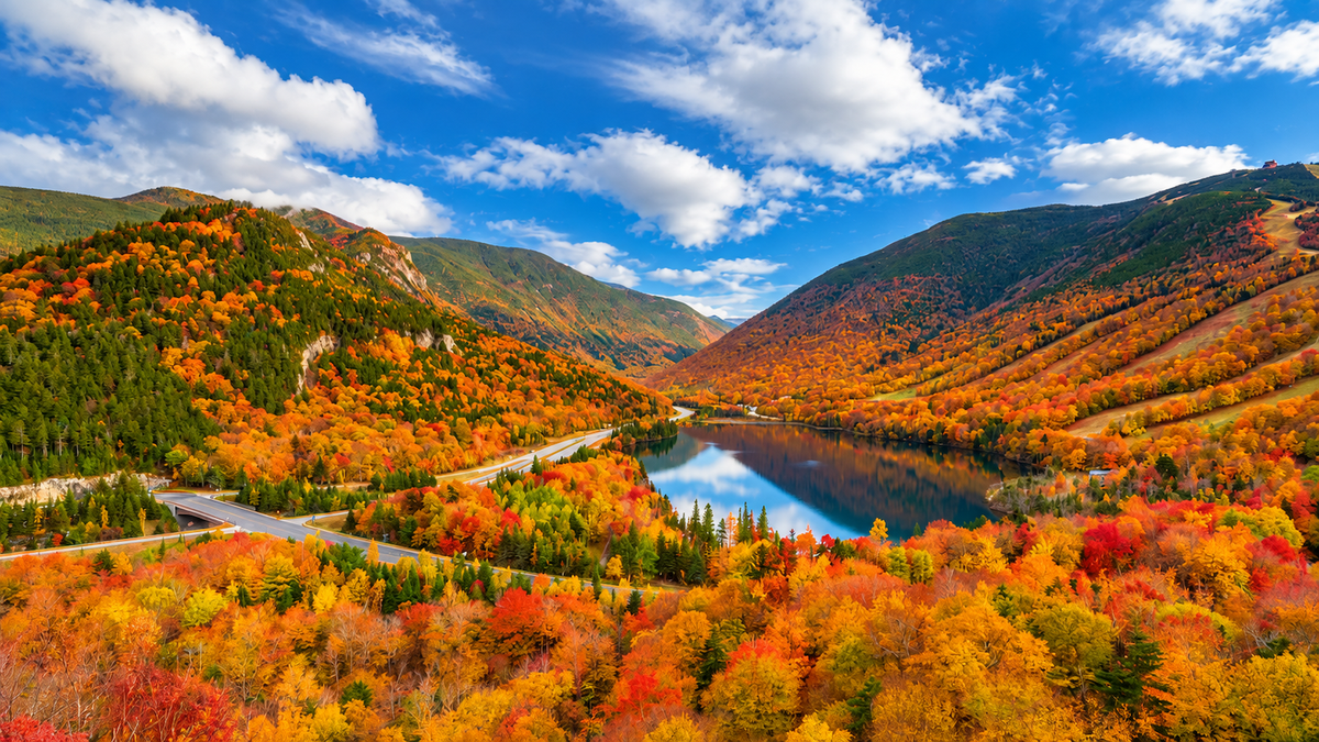
As of September 15, the White Mountains Foliage Tracker places the region at about 10 percent color. Green still dominates the hillsides, but orange and yellow have begun creeping into lower elevations. Franconia and Pinkham notches are showing yellow higher on the mountains, while portions of the Kancamagus Highway have begun picking up red, orange and yellow, particularly toward its western end and higher ground.
We are still weeks away from the color that will eventually cover these mountains. Historically, the White Mountains reach their most brilliant foliage during the first two weeks of October. But peak color was never the point of this journey. We’re following autumn as it moves, and in New Hampshire, we’re going higher to meet it.
Into Franconia Notch
The road into Franconia Notch State Park wastes little time introducing the White Mountains. Interstate 93 narrows as it enters the pass, with the Franconia Range rising to the east and the Kinsman Range to the west. What appears on a map to be a highway through the mountains begins to feel much more like a road allowed passage between them.
This is part of the White Mountains Trail, a scenic route connecting Franconia Notch with Crawford Notch, the Kancamagus Highway and other landscapes across the region. It would be possible to spend the day following the road from viewpoint to viewpoint, but it would also be a shame never to step away from it.
Franconia Notch offers mountain lakes, trails, waterfalls and the unmistakable profile of Cannon Mountain rising above the valley. Near the southern end of the park, however, the landscape draws inward. There, water has opened a passage through stone.
Inside the Flume
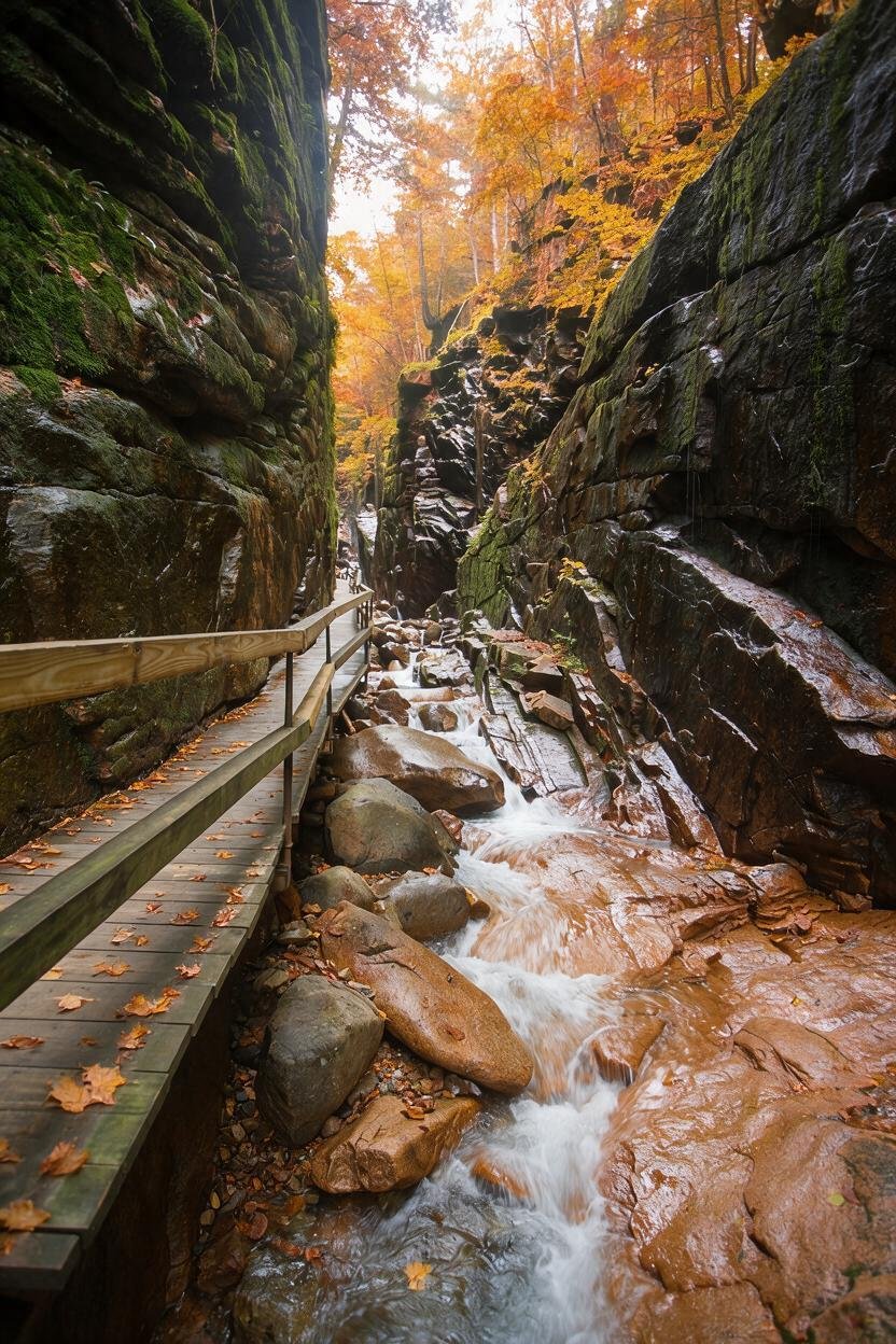
At Flume Gorge, the enormous scale of the White Mountains suddenly becomes intimate. The natural gorge extends roughly 800 feet along the base of Mount Liberty. Walls of Conway granite rise 70 to 90 feet and, at their narrowest, stand only 12 feet apart. A wooden boardwalk follows Flume Brook through the gorge, passing among ferns, mosses and flowers growing in the damp shelter of the rock walls. At the upper end, Avalanche Falls drops about 45 feet into the gorge.
It is a very different way to encounter these mountains. Much of what makes the White Mountains famous is enormous: long ridges, high summits and views stretching across miles of forest. Inside the Flume, your attention is pulled closer. Water moves around boulders, ferns spill from cracks in the granite, moss softens stone that otherwise looks immovable, and the boardwalk disappears ahead between walls shaped by water and time.
In mid-September, much of this forest is still green, and that feels right. We are not seeing autumn after it has finished transforming the landscape. We’re watching the transformation happen. A yellow leaf among green ones matters here, as does a maple somewhere above the rock beginning to change ahead of its neighbors.
Sometimes a season announces itself across an entire mountainside. Sometimes it starts with one tree.
The Mountain With the Missing Face
There is another story written into the stone of Franconia Notch. For generations, five granite ledges high on Cannon Mountain aligned from below to create the profile of a man’s face.
The Old Man of the Mountain became an emblem of New Hampshire, appearing on license plates, road signs and the state’s quarter. Then, sometime during the night of May 3, 2003, the formation collapsed. People woke to discover that a face seemingly carved into the mountain had disappeared.
Today, the Old Man of the Mountain Profile Plaza looks toward the cliff where the Old Man once appeared. Steel profilers allow visitors standing in the correct position to recreate the familiar outline against the mountain.
There is something strangely appropriate about encountering that story while chasing autumn. We speak about mountains as though they are permanent and seasons as though they are fleeting, but the mountains change too. We simply aren’t always here long enough to watch.
Across the Kancamagus
From Lincoln, Route 112 begins one of the best-known drives in New England. The Kancamagus Highway travels 34.5 miles through the White Mountain National Forest between Lincoln and Conway. Through its mountain section there are no restaurants, hotels, gas stations or commercial strips interrupting the forest.
The Swift River follows portions of the road, trailheads disappear beneath the trees, and overlooks open toward mountains that will soon become the subject of countless autumn photographs. Today, however, most of them are still green.
This is where it becomes tempting to hurry the season, but there is no reason to. The September 15 foliage report is already finding red, orange and yellow along the Kanc, particularly toward the western end and around the height of land, yet the region overall remains only about 10 percent changed.
The famous October landscape exists here now only in pieces. One hillside has begun to change while another waits. Color gathers around a wetland or appears beside the river. A tree glowing red among hundreds still wearing summer green can attract more attention than an entire red hillside will a few weeks from now.
Perhaps that’s because right now every changing tree seems to be telling us the same thing.
It’s coming.
Through Crawford Notch
Another road carries us deeper into the mountains. Route 302 passes through Crawford Notch State Park, where steep mountains close around the valley and trails lead toward waterfalls, lakes and high ridges.
There are ambitious ways to explore this country, and there are quiet ones. A traveler can walk near Saco Lake, stop for a view of Silver Cascade or simply follow the road through the notch while mountains rise on either side.
That distinction matters in a place celebrated for strenuous hiking. The White Mountains deserve respect. Their trails climb serious terrain, and conditions at elevation can change quickly. But these mountains do not belong only to the people capable of climbing to their summits. You can hike a ridge, walk beside a lake, follow a boardwalk through a gorge or pull safely off the road at an overlook and stand there as long as you please.
There is no requirement that beauty be earned through exhaustion.
Mount Washington
Eventually, the mountains lead toward one that seems to exist on a different scale. Mount Washington State Park occupies the summit of the highest peak in the Northeast, 6,288 feet above sea level. On a clear day, the view can extend more than 100 miles across New England and beyond.
The view is only part of what makes the mountain remarkable. Elevation strips the familiar landscape away as you climb. Forest changes, trees grow shorter, and eventually the sheltered world below gives way to exposed high country where weather can be dramatically different from conditions in the valley.
In a journey following autumn, that climb gives us something unusual. We can move through the season vertically.
The Mount Washington Auto Road has carried travelers up the eastern side of the mountain since 1861, while the Mount Washington Cog Railway climbs from the west. Hiking trails provide another route, though reaching the summit on foot is a serious mountain undertaking rather than a casual autumn walk.
Whichever way you experience the mountain, the lesson is similar. Down below, September may still look like summer. Keep climbing and the illusion becomes harder to maintain. Cold arrives sooner up here, and so does autumn.
A Trail Through the High Country
The Appalachian Trail has been accompanying us since this journey began in Maine. In the White Mountains, its personality changes.
Here, the trail crosses exposed ridges and high summits, including some of the most demanding terrain along the entire route from Georgia to Maine. The forest that shelters hikers farther south sometimes falls away, leaving rock, sky and rapidly changing mountain weather. It is also here that the trail intersects with a tradition distinctive to the White Mountains: the mountain huts.
The Appalachian Mountain Club operates a network of backcountry huts reached on foot throughout the region. Some sit within the forest. Others occupy the high country where the landscape has already left most trees behind.
Lakes of the Clouds Hut sits at 5,012 feet below Mount Monroe. Reaching it from the Ammonoosuc Ravine Trailhead requires a strenuous three-mile climb, and its 2026 full-service season continues through September 19. A little farther north in the Presidential Range, Madison Spring Hut sits at 4,600 feet between Mount Adams and Mount Madison, with its full-service season continuing through September 26.
These aren’t hotels that happen to have mountain views. You have to walk to them, and that changes their place in the landscape. Hikers arrive from different directions and for different reasons. Some are traveling the Appalachian Trail toward Maine. Others are crossing the Presidential Range, climbing a summit or spending a few days in the mountains.
For a night, their paths meet. Morning sends them apart again.
There is something fitting about that temporary community in the Appalachians: people gathering in an isolated place, sharing shelter and a meal, trading pieces of their journeys and then continuing down separate paths. The huts belong to the mountains, but they also belong to the human story of walking through them.
The Communities Below
Eventually, everyone has to come down. The valleys beneath the White Mountains are dotted with communities that have spent generations living alongside people arriving to hike, ski, fish, sightsee, ride trains, climb mountains or simply disappear into the woods for a few days.
Lincoln and North Woodstock sit near the western end of the Kancamagus. Franconia and Sugar Hill lie beyond the notch, while North Conway and Jackson sit on the eastern side of the mountains. These communities give the journey a human scale.
A bakery after a cold morning outside doesn’t need to be famous to become memorable. Neither does an old inn, a cup of cider or a table somewhere near a window when the light begins disappearing from the mountains. This is where local businesses belong in our journey, not as attractions competing with the landscape, but as part of the communities living beneath it.
Stay somewhere small if that suits you. Eat somewhere local. Wander through a village rather than driving directly to the next overlook. The mountains tell only part of the story of the White Mountains. People have been making lives beneath them for a very long time.
When Fall Reaches the Towns
By September, the changing season begins appearing in ways that have nothing to do with foliage reports. Apples return, cider follows, and cool evenings make a warm meal feel different than it did in August. Farm stands begin looking like autumn even when the mountains behind them don’t.
The calendar starts changing too. On September 15, the regional events calendar marks the opening of Much Ado About Nothing at the Weathervane Theatre, one reminder that a day in the White Mountains does not have to end when the trail does.
These details are easy to overlook when the mountains are demanding attention, but they are also part of what we’re following. Autumn is more than chlorophyll disappearing from leaves. It changes what people eat, what they wear, what happens in town and how early everyone notices the evening arriving.
The mountains may not yet look like October, but the communities beneath them already know October is coming.
Before the Mountains Burn Bright
If you came to the White Mountains this week expecting entire mountainsides covered in red, orange and gold, you arrived early. For our journey, you arrived at exactly the right time.
The White Mountains are at roughly 10 percent color. Franconia and Pinkham notches are beginning to show yellow at higher elevations. The western Kancamagus is picking up scattered reds, oranges and yellows, while most of the landscape remains green.
In another few weeks, much of this will be transformed. The White Mountains typically reach their strongest color during the first two weeks of October, although elevation, tree species and weather ensure that no single date can promise peak foliage everywhere.
Come then and the mountains may give you the grand spectacle. Come now and they give you something else: the beginning.
There is a peculiar pleasure in recognizing a season before it becomes impossible to miss.
Plan Your White Mountains Journey
The White Mountains Visitors Center is a useful starting point for current information on scenic drives, lodging, attractions, events and recreation throughout the region.
If foliage is part of the reason for your trip, check both New Hampshire’s official Fall Foliage Tracker and the regional White Mountains Foliage Tracker shortly before leaving. Both are more useful than planning around a historical peak date because the season progresses differently each year.
For hikers, the Appalachian Mountain Club provides information on trails, huts and backcountry planning. AMC also operates a White Mountains hiker shuttle on selected days into October, although its schedule should be checked before relying on it for transportation.
For Mount Washington, check current operating conditions directly with the Mount Washington Auto Road or Mount Washington Cog Railway. Summit conditions can be dramatically different from the weather below, so mountain forecasts deserve attention even when the valley looks perfectly inviting.
If you plan to visit the Flume, check current information through New Hampshire State Parks before setting out. The complete loop is about two miles and includes uphill walking, boardwalks and numerous stairs, and advance reservations are recommended because entry windows can sell out.
Once the practical planning is finished, leave a little of the trip unplanned. Follow the road through one more notch, stop beside the river, walk into the woods or find somewhere warm when you’re hungry.
And if the mountains are greener than the photograph you imagined before you came, don’t be disappointed.
Look closer.
Chasing Fall South
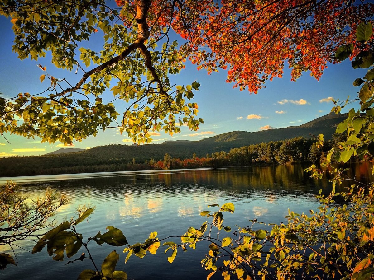
We entered the White Mountains looking for autumn. At first, summer seemed reluctant to let it through. Green still covered the valleys, the forests around the Flume remained lush, and from a distance many of the mountains looked much as they had weeks before.
Then we began to climb. Yellow appeared higher in the notches. Red and orange interrupted the green along the Kancamagus. The air changed as the road gained elevation, and somewhere above the trees, the high country had already moved farther into the season than the valleys below.
For a little while, we caught up.
But autumn is still moving. Behind us, Maine is turning. Soon the White Mountains will follow, and the scattered color we see today will spread across slopes that are still green.
We won’t be here when that happens. We’re chasing fall south, and the mountains ahead are waiting.